Barn Island Boat Ramp
Barn Island Boat Ramp is a slipway in Southeastern Connecticut Planning Region, Connecticut. Barn Island Boat Ramp is situated nearby to the park Barn Island Boat Launch, as well as near the islet Goat Island.| Tap on a place to explore it |
Places of Interest Nearby
Highlights include Goat Island and Elihu Island.
Goat Island
Islet
Goat Island is part of Stonington, Connecticut in Wequetequock Cove. It is just northeast of Elihu Island, and is also close to the coast along the Northeast Corridor. Sandy Point Island is nearby southwest along Little Narragansett Bay.
Elihu Island
Island
Elihu Island is a private island off the coast of Stonington, Connecticut. It is located in Wequetequock Cove, just southwest of Goat Island and northeast of the western tip of Sandy Point Island.
Capt. Nathaniel B. Palmer House
Museum
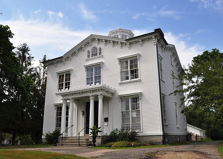
Photo: Wikimedia, CC BY-SA 3.0.
The Capt. Nathaniel B. Palmer House is a historic house museum in Stonington, Connecticut, built in 1852–54. The house is a transitional style between the Greek Revival and the Victorian Italianate. Capt. Nathaniel B. Palmer House is situated 1½ miles west of Barn Island Boat Ramp.
Places in the Area
Nearby places include Stonington and Stonington.
Stonington

Photo: Pi.1415926535, CC BY-SA 3.0.
Stonington is a town located on Long Island Sound in New London County, Connecticut, United States. The municipal limits of the town include the borough of Stonington, the villages of Pawcatuck, Lords Point, and Wequetequock, and the eastern halves of the villages of Mystic and Old Mystic.
Stonington
Town
Stonington is a borough and the town center of Stonington, Connecticut, United States, referred to by locals as "The Borough". The population was 976 at the 2020 United States Census, up from 929 in 2010. Stonington is situated 1½ miles west of Barn Island Boat Ramp.
Watch Hill

Photo: Juliancolton, Public domain.
Watch Hill is a district in Westerly, which is a town in Rhode Island. Watch Hill is a wealthy, summer tourist district comprised of two main streets. Most of the homes are summer mansions.
Barn Island Boat Ramp
- Type: Slipway
- Categories: recreation area and transportation
- Location: Southeastern Connecticut Planning Region, Connecticut, New England, United States, North America
- View on OpenStreetMap
Latitude
41.33744° or 41° 20′ 15″ northLongitude
-71.87556° or 71° 52′ 32″ westOpen location code
87HC84PF+XQOpenStreetMap ID
node 5309202483OpenStreetMap feature
leisure=slipway
This page is based on OpenStreetMap, Wikidata, and Wikimedia Commons.
We’d love your help improving our open data sources. Thank you for contributing.
Satellite Map
Discover Barn Island Boat Ramp from above in high-definition satellite imagery.
Notable Places Nearby
Highlights include Barn Island Boat Launch and Barn Island.
Nearby Places
Explore places such as Barn Island WMA Trailhead Parking and Elihu Island Road.
Connecticut: Must-Visit Destinations
Delve into Hartford, New Haven, Bridgeport, and Stamford.
Curious Slipways to Discover
Uncover intriguing slipways from every corner of the globe.
About Mapcarta. Data © OpenStreetMap contributors and available under the Open Database License". Text is available under the CC BY-SA 4.0 license, except for photos, directions, and the map. Photo: Wikimedia, CC0.