Epa Belén
Epa Belén is a bus stop in Ulloa, Heredia. Epa Belén is situated nearby to the grassland Parque Los Tanques, as well as near the health club Smart Fit.| Tap on a place to explore it |
Places of Interest Nearby
Highlights include Tobías Bolaños International Airport and San José Costa Rica Temple.
Tobías Bolaños International Airport
Aerodrome
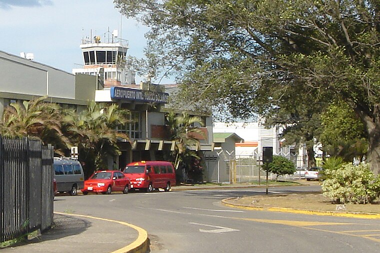
Photo: Mariordo, CC BY-SA 3.0.
Tobías Bolaños International Airport is one of four international airports in Costa Rica, and the secondary airport serving the city of San José, after Juan Santamaría International Airport. Tobías Bolaños International Airport is situated 4 km southeast of Epa Belén.
San José Costa Rica Temple
Church
The San José Costa Rica Temple is the 87th operating temple of the Church of Jesus Christ of Latter-day Saints. The church's First Presidency announced on March 17, 1999, that a temple would be built in San José, Costa Rica. San José Costa Rica Temple is situated 2½ km west of Epa Belén.
Places in the Area
Nearby places include San Pedro de Santa Bárbara and Heredia.
San Pedro de Santa Bárbara
Village

Photo: Mvblair, CC BY-SA 3.0.
San Pedro, is one of the six districts of the Santa Bárbara canton, in the Heredia province of Costa Rica. It is located 2.5 kilometers west of Santa Bárbara and is officially a part of the province of Heredia. San Pedro de Santa Bárbara is situated 5 km north of Epa Belén.
Heredia

Photo: Rquesada, CC BY-SA 3.0.
Heredia region of the Central Valley offers much for the visitor in downtown Heredia, and in many of the towns around Heredia, particularly in the north mountains, like Barva, San Rafael, San Isidro, where there are many coffee plantations and fresh air year round.
Barva
Town

Photo: Tillor87, CC BY-SA 3.0.
Barva is a district of the Barva canton, in the Heredia province of Costa Rica. The city is known for having a nice mix of rural and metropolitan landscape. Barva is situated 6 km northeast of Epa Belén.
Epa Belén
- Type: Bus stop
- Categories: transport stop and transportation
- Location: Ulloa, Heredia, Heredia Province, Costa Rica, Central America, North America
- View on OpenStreetMap
Latitude
9.98226° or 9° 58′ 56″ northLongitude
-84.16286° or 84° 9′ 46″ westOpen location code
66XQXRJP+WVOpenStreetMap ID
node 5310483756OpenStreetMap feature
public_transport=stop_position
This page is based on OpenStreetMap, Wikidata, and Wikimedia Commons.
We’d love your help improving our open data sources. Thank you for contributing.
Satellite Map
Discover Epa Belén from above in high-definition satellite imagery.
Notable Places Nearby
Highlights include Parque Los Tanques and Smart Fit.
Nearby Places
Explore places such as Epa Belén and Epa.
Costa Rica: Must-Visit Destinations
Delve into San José, Alajuela, Puerto Limón, and Liberia.
Curious Bus Stops to Discover
Uncover intriguing bus stops from every corner of the globe.
About Mapcarta. Data © OpenStreetMap contributors and available under the Open Database License". Text is available under the CC BY-SA 4.0 license, except for photos, directions, and the map. Photo: Henry Zbyszynski, CC BY 2.0.