Quincy Center
Quincy Center is a railway stop in City of Quincy, Norfolk, Massachusetts. Quincy Center is situated nearby to the town hall Quincy City Hall, as well as near the park Hancock Adams Common.| Tap on a place to explore it |
Places of Interest Nearby
Highlights include Quincy City Hall and United First Parish Church.
Quincy City Hall
Town hall
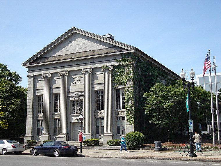
Photo: Sswonk, Public domain.
Quincy City Hall is the seat of government for the City of Quincy, Massachusetts. The historic town hall building at 1305 Hancock Street in Quincy Center was built in 1844.
United First Parish Church
Place of worship

Photo: Daderot, CC BY-SA 3.0.
United First Parish Church is an American Unitarian Universalist congregation in Quincy, Massachusetts, established as the parish church of Quincy in 1639. United First Parish Church is situated 580 feet east of Quincy Center.
Hancock Cemetery
Cemetery

Photo: Sswonk, CC BY-SA 3.0.
Hancock Cemetery is a historic cemetery on the Hancock Adams Common, across from the United First Parish Church, in Quincy, Massachusetts, United States. Hancock Cemetery is situated 400 feet southeast of Quincy Center.
Places in the Area
Nearby places include Quincy and Adams Shore.
Quincy
Photo: Sswonk, Public domain.
Quincy is in Massachusetts. Quincy was the birthplace of presidents John Adams and John Quincy Adams. United States Declaration of Independence signer and first Massachusetts governor John Hancock was also born here.
Adams Shore
Hamlet
Adams Shore is a neighborhood of Quincy, Massachusetts. It is located on the shore of Quincy Bay at the entrance to the Hough's Neck peninsula. It is bordered on the north by Quincy Bay, on the east by the Hough's Neck neighborhood, on the south by Town River Bay and on the west by the Merrymount neighborhood.
Braintree Split
Locality
The Braintree Split is the major interchange of Interstate 93, U.S. Route 1, and Route 3 in Braintree, Massachusetts, one of the South Shore suburbs of Boston. Braintree Split is situated 2 miles southwest of Quincy Center.
Quincy Center
- Type: Railway stop
- Categories: transport stop and transportation
- Location: City of Quincy, Norfolk, Massachusetts, New England, United States, North America
- View on OpenStreetMap
Latitude
42.25098° or 42° 15′ 4″ northLongitude
-71.00503° or 71° 0′ 18″ westOpen location code
87JC7X2V+9XOpenStreetMap ID
node 5333783427OpenStreetMap feature
public_transport=stop_positionOpenStreetMap feature
railway=stop
This page is based on OpenStreetMap, Wikidata, and Wikimedia Commons.
We’d love your help improving our open data sources. Thank you for contributing.
Satellite Map
Discover Quincy Center from above in high-definition satellite imagery.
Places with the Same Name
Discover other places named “Quincy Center”.
Notable Places Nearby
Highlights include Quincy Town Hall and Hancock Adams Common.
Nearby Places
Explore places such as Quincy Center and Advanced Dental Care.
Massachusetts: Must-Visit Destinations
Delve into Boston, Cambridge, Springfield, and Worcester.
Curious Railway Stops to Discover
Uncover intriguing railway stops from every corner of the globe.
About Mapcarta. Data © OpenStreetMap contributors and available under the Open Database License". Text is available under the CC BY-SA 4.0 license, except for photos, directions, and the map. Photo: papadunes, CC BY-SA 3.0.