Choc’s Grocery
Choc’s Grocery is a convenience store in Belize District, Belize. Choc’s Grocery is situated nearby to the town Ladyville, as well as near Sinai Adventist Church.| Tap on a place to explore it |
Places of Interest Nearby
Highlights include Philip S. W. Goldson International Airport and Price Barracks.
Philip S. W. Goldson International Airport
Aerodrome
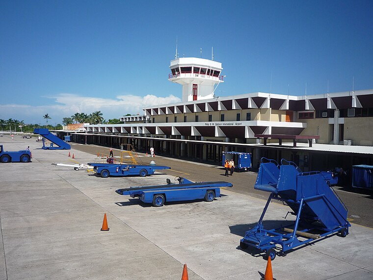
Photo: Pgbk87, CC BY-SA 3.0.
Philip S. W. Goldson International Airport is an airport that serves the nation of Belize's largest city, Belize City along the eastern coast of Central America.
Price Barracks
Military installation

Photo: Wikimedia, Public domain.
Price Barracks is a military installation located just north of Philip S. W. Goldson International Airport which is located in Ladyville some 8 miles to the north west of Belize City. It is the main base of the Belize Defence Force. Price Barracks is situated 1¼ miles west of Choc’s Grocery.
Places in the Area
Nearby places include Ladyville and Lord’s Bank.
Ladyville
Town
Ladyville is the largest village in the country of Belize, eight miles northwest of Belize City in the Belize District. The Philip Goldson Highway connects Ladyville to Belize City.
Lord’s Bank
Village
Lord's Bank is a village in Belize District in the nation of Belize, Central America. Lord’s Bank is situated 2 miles west of Choc’s Grocery.
Choc’s Grocery
- Type: Convenience store
- Categories: shop and food
- Location: Belize District, Belize, Central America, North America
- View on OpenStreetMap
Latitude
17.55259° or 17° 33′ 9″ northLongitude
-88.2902° or 88° 17′ 25″ westOpen location code
769HHP35+2WOpenStreetMap ID
node 5334180721OpenStreetMap feature
shop=convenience
This page is based on OpenStreetMap, Wikidata, and Wikimedia Commons.
We’d love your help improving our open data sources. Thank you for contributing.
Satellite Map
Discover Choc’s Grocery from above in high-definition satellite imagery.
Notable Places Nearby
Highlights include Ladyville Police Station and Ladyville Seventh Day Adventists.
Nearby Places
Explore places such as Hernández Shop and Perez Hardware.
Belize District: Must-Visit Destinations
Delve into Belize City, Ambergris Caye, Caye Caulker, and Altun Ha.
Curious Convenience Stores to Discover
Uncover intriguing convenience stores from every corner of the globe.
About Mapcarta. Data © OpenStreetMap contributors and available under the Open Database License". Text is available under the CC BY-SA 4.0 license, except for photos, directions, and the map. Photo: Wikimedia, CC0.