Store Kongehøj
Store Kongehøj is an archaeological site in Kolding Municipality, Region of Southern Denmark. Store Kongehøj is situated nearby to the hill Guldhøj, as well as near the village Vamdrup.| Tap on a place to explore it |
Places of Interest Nearby
Highlights include Vamdrup Station and Vamdrup Church.
Vamdrup Station
Railway station

Photo: Hjart, CC BY-SA 4.0.
Vamdrup Station is a railway station, which is situated 3 km southeast of Store Kongehøj.
Vamdrup Church
Church

Photo: Hjart, CC BY-SA 4.0.
Vamdrup Church is situated 2½ km southeast of Store Kongehøj.
Kongeåmuseet
Museum
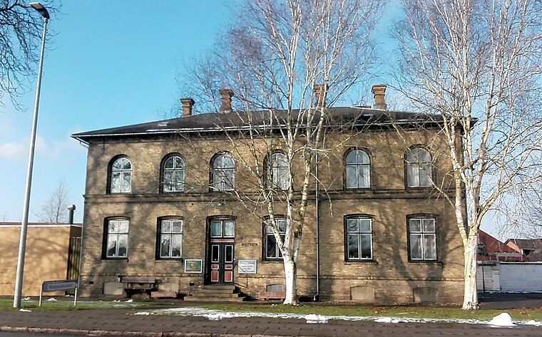
Photo: Beethoven9, CC BY-SA 4.0.
Kongeåmuseet is a museum, which is situated 3 km southeast of Store Kongehøj.
Places in the Area
Nearby places include Vamdrup and Store Andst.
Vamdrup
Village

Photo: Hjart, CC BY-SA 4.0.
Vamdrup is a railway town in the Region of Southern Denmark, near Kolding in Denmark with a population of 4,940. Vamdrup is served by Vamdrup station on the Fredericia–Padborg railway line. Vamdrup is situated 3½ km east of Store Kongehøj.
Store Andst
Village

Photo: Hejsa, Public domain.
Store Andst is a village in Vejen Municipality of Southern Jylland, Denmark with a population of 792. Andst Church is the parish church located on a hill in the middle of the village. Store Andst is situated 5 km north of Store Kongehøj.
Skodborg
Village

Photo: Hjart, CC BY-SA 4.0.
Skodborg is a small town, with a population of 1,221, in Vejen Municipality, Region of Southern Denmark in Denmark. Skodborg is located 29 km southwest of Kolding, 35 km northwest of Haderslev, 10 km northeast of Rødding and 9 km south of Vejen. Skodborg is situated 6 km southwest of Store Kongehøj.
Store Kongehøj
- Type: Archaeological site
- Description: ancient monument in Kolding Municipality (73314)
- Categories: tumulus, historic site, tourist attraction, and tourism
- Location: Kolding Municipality, Region of Southern Denmark, Denmark, Nordic countries, Europe
- View on OpenStreetMap
Latitude
55.43927° or 55° 26′ 21″ northLongitude
9.23919° or 9° 14′ 21″ eastOpen location code
9F7FC6QQ+PMOpenStreetMap ID
node 5335199026OpenStreetMap feature
historic=archaeological_siteWikidata ID
Q30139658
This page is based on OpenStreetMap, Wikidata, and Wikimedia Commons.
We’d love your help improving our open data sources. Thank you for contributing.
Satellite Map
Discover Store Kongehøj from above in high-definition satellite imagery.
In Other Languages
From Danish to Finnish—“Store Kongehøj” goes by many names.
- Danish: “Store Kongehøj”
- Finnish: “Store Kongehøj”
Notable Places Nearby
Highlights include Guldhøj and Vamdrup Kirkegård.
Nearby Places
Explore places such as Hafdrup and Vandmøllegården.
Denmark: Must-Visit Destinations
Delve into Copenhagen, Aarhus, Odense, and Aalborg.
Curious Archaeological Sites to Discover
Uncover intriguing archaeological sites from every corner of the globe.
About Mapcarta. Data © OpenStreetMap contributors and available under the Open Database License". Text is available under the CC BY-SA 4.0 license, except for photos, directions, and the map. Photo: Wikimedia, CC BY-SA 3.0.