Pah Rah Playground
Pah Rah Playground is a playground in Washoe County, Nevada. Pah Rah Playground is situated nearby to Pah Rah Mountain Park, as well as near the pitch Horseshoe Pits.| Tap on a place to explore it |
Places of Interest Nearby
Highlights include Edward C Reed High School and Excel Christian School.
Edward C Reed High School
School
Edward C. Reed High School is a public secondary school in Sparks, Nevada and is one of three public high schools run by the Washoe County School District within the city of Sparks. Edward C Reed High School is situated 1 mile southwest of Pah Rah Playground.
Excel Christian School
School
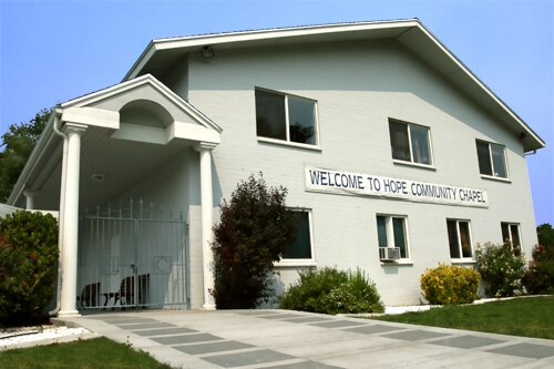
Photo: MarketingMan12, Public domain.
Excel Christian School is an accredited private Pre-K through grade 12 Christian school in Sparks, Nevada, founded in 2003 as a non-profit organization. The school mascot is the Warriors, and the school colors are red and black. Excel Christian School is situated 1¼ miles west of Pah Rah Playground.
Wild Island
Water park

Photo: Tim36272, CC BY-SA 3.0.
Wild Island is a water park located off I-80 in the city of Sparks, Nevada. The park is the only one in the vicinity of the double city. Wild Island opened in June 1989 and has grown and expanded throughout its history. Wild Island is situated 2½ miles south of Pah Rah Playground.
Places in the Area
Nearby places include Sparks and Sun Valley.
Sparks

Photo: Wikimedia, CC BY-SA 3.0.
Sparks is a city in Washoe County, Nevada, United States. It was founded in 1904, incorporated on March 15, 1905, and is located just east of Reno. The 2020 U.S. Census counted 108,445 residents in the city.
Sun Valley
Town
Sun Valley is a census-designated place in Washoe County, Nevada, United States. The population was 21,178 at the 2020 census. It is north of Reno and is part of the Reno-Sparks metropolitan area. Sun Valley is situated 4½ miles northwest of Pah Rah Playground.
Lockwood
Village

Photo: Ken Lund, CC BY-SA 2.0.
Lockwood is an unincorporated community on the northern edge of Storey County, Nevada, United States, about 10 miles east of Reno and Sparks. Lockwood is part of the Reno-Sparks Metropolitan Area. Lockwood is situated 5 miles southeast of Pah Rah Playground.
Pah Rah Playground
- Type: Playground
- Category: recreation area
- Location: Washoe County, Nevada, Southwest, United States, North America
- View on OpenStreetMap
Latitude
39.56433° or 39° 33′ 52″ northLongitude
-119.7084° or 119° 42′ 30″ westOpen location code
85F2H77R+PJOpenStreetMap ID
node 5337808719OpenStreetMap feature
leisure=playground
This page is based on OpenStreetMap, Wikidata, and Wikimedia Commons.
We’d love your help improving our open data sources. Thank you for contributing.
Satellite Map
Discover Pah Rah Playground from above in high-definition satellite imagery.
Notable Places Nearby
Highlights include Pah Rah Mountain Park and Horseshoe Pits.
Nearby Places
Explore places such as Jerry Whitehead Elementary School and Pritchett Eye Care Associates.
Nevada: Must-Visit Destinations
Delve into Las Vegas, Carson City, Reno, and Henderson and East.
Curious Playgrounds to Discover
Uncover intriguing playgrounds from every corner of the globe.
About Mapcarta. Data © OpenStreetMap contributors and available under the Open Database License". Text is available under the CC BY-SA 4.0 license, except for photos, directions, and the map. Photo: exothermic, CC BY 2.0.