Camp de Bavay
Camp de Bavay is a residential area in Lille, North, Hauts-de-France and has about 140 residents. Camp de Bavay is situated nearby to the post office Relais La Poste, as well as near the government office Irev.| Tap on a place to explore it |
Places of Interest Nearby
Highlights include Gare de Lille Europe and Porte de Valenciennes.
Gare de Lille Europe
Railway station

Photo: JÄNNICK Jérémy, Public domain.
Lille–Europe station is a SNCF railway station in Lille, France, on the LGV Nord high-speed railway. The station is primarily used for international Eurostar and long-distance SNCF TGV services, although some high-speed regional trains also call at the station. Gare de Lille Europe is situated 1½ km north of Camp de Bavay.
Porte de Valenciennes
Metro station

Photo: Jérémy-Günther-Heinz Jähnick, GFDL.
Porte de Valenciennes is a metro station, which is situated 490 metres southwest of Camp de Bavay.
Gare de Lille Flandres
Railway station
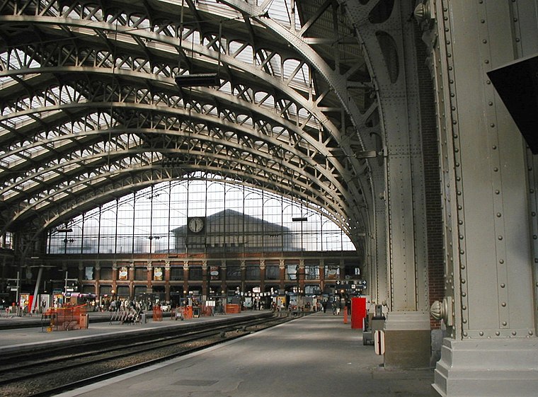
Photo: Wikimedia, Public domain.
Lille-Flandres station is the main railway station of Lille, capital of French Flanders. It is a terminus for SNCF Intercity and regional trains. It opened in 1842 as the Gare de Lille, but was renamed in 1993 when Lille Europe station opened. Gare de Lille Flandres is situated 1½ km northwest of Camp de Bavay.
Places in the Area
Nearby places include Porte de Valenciennes and Fives.
Porte de Valenciennes
Locality

Photo: VVVCFFrance, CC BY-SA 4.0.
Porte de Valenciennes is a locality.
Fives
Suburb

Photo: PIERRE ANDRE LECLERCQ, CC BY-SA 4.0.
Fives is a former commune in the Nord department in northern France. It has been part of Lille since 1858. It gave its name to an engineering group founded in the nineteenth century, the Compagnie de Fives-Lille.

Camp de Bavay
- Type: Residential area
- Location: Lille, Arrondissement of Lille, North, Hauts-de-France, France, Europe
- View on OpenStreetMap
Latitude
50.62432° or 50° 37′ 28″ northLongitude
3.08364° or 3° 5′ 1″ eastPopulation
140Open location code
9F25J3FM+PFOpenStreetMap ID
node 5339468525OpenStreetMap feature
landuse=residential
This page is based on OpenStreetMap, Wikidata, and Wikimedia Commons.
We’d love your help improving our open data sources. Thank you for contributing.
Satellite Map
Discover Camp de Bavay from above in high-definition satellite imagery.
Notable Places Nearby
Highlights include Relais La Poste and Irev.
Nearby Places
Explore places such as Abej-solidarité and ZAC ‘Porte de Valenciennes’ - Lot 1.4.
Hauts-de-France: Must-Visit Destinations
Delve into Dunkirk, Calais, Amiens, and Arras.
Curious Residential Areas to Discover
Uncover intriguing residential areas from every corner of the globe.
About Mapcarta. Data © OpenStreetMap contributors and available under the Open Database License". Text is available under the CC BY-SA 4.0 license, except for photos, directions, and the map. Photo: Velvet, CC BY-SA 3.0.