Mai Tawandas place
Mai Tawandas place is a school in Bulawayo, Zimbabwe. Mai Tawandas place is situated nearby to Mater Dei Hospital, as well as near the suburb Bradfield.| Tap on a place to explore it |
Places of Interest Nearby
Highlights include Bulawayo Athletic Club and Bulawayo Railway Museum.
Bulawayo Athletic Club
Sports venue
Bulawayo Athletic Club is a sports club in Bulawayo, Zimbabwe. The Bulawayo Athletic Club Ground is a 12,000-capacity stadium. Bulawayo Athletic Club is situated 1½ km north of Mai Tawandas place.
Bulawayo Railway Museum
Museum
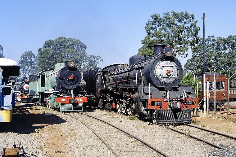
Photo: H.G.Graser, CC BY-SA 3.0.
Bulawayo Railway Museum is a railway museum located at Bulawayo railway station in Zimbabwe that houses several exhibitions on the history of the railway system in Zimbabwe, formerly Rhodesia. Bulawayo Railway Museum is situated 3 km northwest of Mai Tawandas place.
National Library of Zimbabwe
Library
The National Library of Zimbabwe also known National Free Library of Zimbabwe is located in Bulawayo second biggest city in Zimbabwe. It was established under the National Library and Documentation Service Act Chapter 25:10 act of 1985 which was passed by the Zimbabwean Government in 1985. National Library of Zimbabwe is situated 2 km north of Mai Tawandas place.
Places in the Area
Nearby places include Bradfield and Bulawayo.
Bulawayo

Photo: Digr, CC BY-SA 3.0.
Bulawayo is a relaxed, elegant industrial city with wide tree-lined boulevards, in western Zimbabwe. Several World Heritage sites, including historic monuments from the precolonial era and national parks, are within an hour's drive from Bulawayo, making it a great tourist destination.
Makokoba
Suburb
Makhokhoba is a suburb of Bulawayo, Zimbabwe. It was the first black African township in the city. The suburb is named after the actions of Mr Fallon, the Native Commissioner, who used walk around with a stick. Makokoba is situated 5 km northwest of Mai Tawandas place.
Mai Tawandas place
- Type: School
- Category: education
- Location: Bulawayo, Zimbabwe, Southern Africa, Africa
- View on OpenStreetMap
Latitude
-20.18051° or 20° 10′ 50″ southLongitude
28.59533° or 28° 35′ 43″ eastOpen location code
5GFCRH9W+Q4OpenStreetMap ID
node 5340280521OpenStreetMap feature
amenity=school
This page is based on OpenStreetMap, Wikidata, and Wikimedia Commons.
We’d love your help improving our open data sources. Thank you for contributing.
Satellite Map
Discover Mai Tawandas place from above in high-definition satellite imagery.
Notable Places Nearby
Highlights include Mater Dei Hospital and Picassos Art.
Nearby Places
Explore places such as KFC and Pinetown Stationary.
Zimbabwe: Must-Visit Destinations
Delve into Harare, Victoria Falls, Bulawayo, and Great Zimbabwe.
Curious Schools to Discover
Uncover intriguing schools from every corner of the globe.
About Mapcarta. Data © OpenStreetMap contributors and available under the Open Database License". Text is available under the CC BY-SA 4.0 license, except for photos, directions, and the map. Photo: Digr, CC BY-SA 3.0.