Paudex, Village
Paudex, Village is a bus stop in Paudex, Lavaux-Oron District, Vaud. Paudex, Village is situated nearby to the community center Grande Salle, as well as near Espace Jean-Pascal Delamuraz.| Tap on a place to explore it |
Places of Interest Nearby
Highlights include Saint-Martin catholic church and La Conversion railway station.
Saint-Martin catholic church
Church

Photo: Odrade123, CC BY-SA 3.0.
Saint-Martin catholic church is situated 280 metres east of Paudex, Village.
La Conversion railway station
Railway station
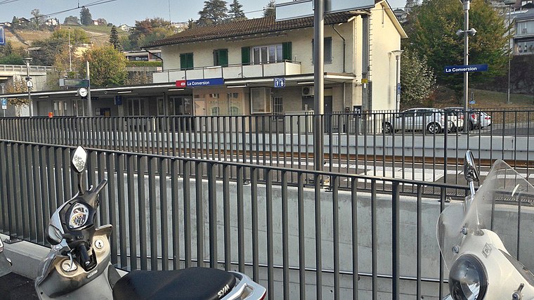 La Conversion railway station is a railway station in the municipality of Lutry, in the Swiss canton of Vaud. It is an intermediate stop on the standard gauge Lausanne–Bern line of Swiss Federal Railways. La Conversion railway station is situated 1 km northeast of Paudex, Village.
Musée de Pully
Museum

Photo: Wikimedia, CC BY-SA 4.0.
Musée de Pully is a museum, which is situated 1 km west of Paudex, Village.
Places in the Area
Nearby places include Pully and Lutry.
Pully
Town
 Pully is a municipality in Switzerland in the canton of Vaud, located in the district of Lavaux-Oron. It is one of the eastern suburbs of the city of Lausanne, located on the shores of Lake Geneva and at the foot of the vineyards of Lavaux on the road to Vevey and Montreux.
Lutry
Town

Photo: Wikimedia, CC BY-SA 3.0.
Lutry is a municipality in the Swiss canton of Vaud, located in the Lavaux-Oron, which includes the Lavaux region, a UNESCO World Heritage site.
Belmont-sur-Lausanne
Village

Photo: Sissssou, CC BY-SA 3.0.
Belmont-sur-Lausanne is a municipality in the district of Lavaux-Oron in the canton of Vaud in Switzerland. It is a suburb of the city of Lausanne.
Paudex, Village
- Type: Bus stop
- Categories: transport stop and transportation
- Location: Paudex, Lavaux-Oron District, Vaud, Western Switzerland, Switzerland, Central Europe, Europe
- View on OpenStreetMap
Latitude
46.50652° or 46° 30′ 24″ northLongitude
6.67327° or 6° 40′ 24″ eastOperator
TLNetwork
MobilisOpen location code
8FR8GM4F+J8OpenStreetMap ID
node 5340504042OpenStreetMap feature
highway=bus_stopOpenStreetMap feature
public_transport=stop_position
This page is based on OpenStreetMap, Wikidata, and Wikimedia Commons.
We’d love your help improving our open data sources. Thank you for contributing.
Satellite Map
Discover Paudex, Village from above in high-definition satellite imagery.
Notable Places Nearby
Highlights include Grande Salle and Espace Jean-Pascal Delamuraz.
Nearby Places
Explore places such as Paudex and TopShop.
Vaud: Must-Visit Destinations
Delve into Lausanne, Montreux, Nyon, and Vevey.
Curious Bus Stops to Discover
Uncover intriguing bus stops from every corner of the globe.
About Mapcarta. Data © OpenStreetMap contributors and available under the Open Database License". Text is available under the CC BY-SA 4.0 license, except for photos, directions, and the map. Photo: Annickjaquillard, CC BY-SA 4.0.