Traktor-Schwingreifen
Traktor-Schwingreifen is a playground in Sigmaringen, Tübingen Region, Baden-Württemberg. Traktor-Schwingreifen is situated nearby to the sports venue Donaubad Sigmaringen, as well as near the swimming pool Kinderbecken.| Tap on a place to explore it |
Places of Interest Nearby
Highlights include Sigmaringen Castle and Stadthalle Sigmaringen.
Sigmaringen Castle
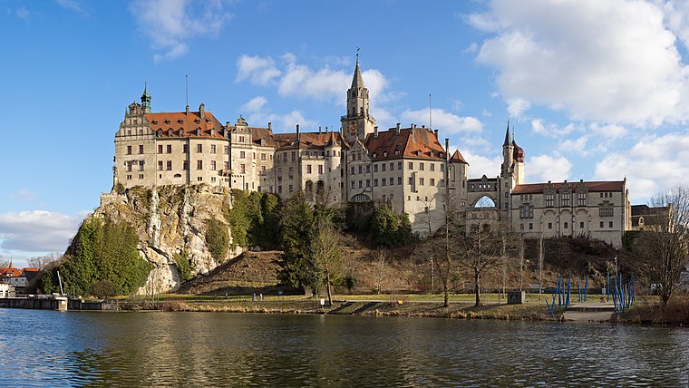
Photo: Milseburg, CC BY-SA 4.0.
Sigmaringen Castle was the princely castle and seat of government for the Princes of Hohenzollern-Sigmaringen. Situated in the Swabian Alb region of Baden-Württemberg, Germany, this castle dominates the skyline of the town of Sigmaringen. Sigmaringen Castle is situated 1¼ km northeast of Traktor-Schwingreifen.
Stadthalle Sigmaringen
Community center

Photo: Windharp, CC BY-SA 4.0.
Stadthalle Sigmaringen is a community center, which is situated 1 km northeast of Traktor-Schwingreifen.
Rathaus Sigmaringen
Town hall

Photo: LepoRello, CC BY-SA 3.0.
Rathaus Sigmaringen is a town hall, which is situated 1¼ km northeast of Traktor-Schwingreifen.
Places in the Area
Nearby places include Inzigkofen and Sigmaringendorf.
Inzigkofen
Village

Photo: Simisa, CC BY-SA 3.0.
Inzigkofen is a municipality in the district of Sigmaringen in Baden-Württemberg in Germany. Historically, it is part of the Swabian north Alpine foreland basin.
Sigmaringendorf
Village
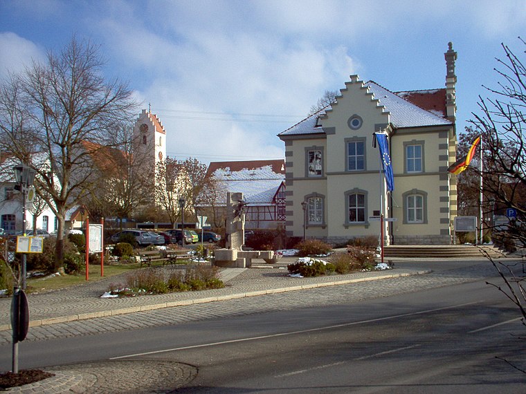
Photo: Louis Bafrance, CC BY-SA 3.0.
Sigmaringendorf is a small town in the district of Sigmaringen in Baden-Württemberg in Germany. In Sigmaringendorf the small river Lauchert flows into the Danube. There is an open-air-theatre in Sigmaringendorf, it's called Waldbühne Sigmaringendorf. Sigmaringendorf is situated 4½ km east of Traktor-Schwingreifen.
Vilsingen
Village

Photo: Simisa, CC BY-SA 3.0.
Vilsingen is a village, which is situated 5 km west of Traktor-Schwingreifen.
Traktor-Schwingreifen
- Type: Playground
- Category: recreation area
- Location: Sigmaringen, Sigmaringen, Tübingen Region, Bodensee Region, Baden-Württemberg, Germany, Central Europe, Europe
- View on OpenStreetMap
Latitude
48.07813° or 48° 4′ 41″ northLongitude
9.20533° or 9° 12′ 19″ eastOpen location code
8FWF36H4+74OpenStreetMap ID
node 5341441944OpenStreetMap feature
leisure=playground
This page is based on OpenStreetMap, Wikidata, and Wikimedia Commons.
We’d love your help improving our open data sources. Thank you for contributing.
Satellite Map
Discover Traktor-Schwingreifen from above in high-definition satellite imagery.
Notable Places Nearby
Highlights include Donaubad Sigmaringen and Kinderbecken.
Nearby Places
Explore places such as Laiz Fa. Eisele and Freibad Sigmaringen.
Bodensee Region: Must-Visit Destinations
Delve into Konstanz, Friedrichshafen, Ravensburg, and Überlingen.
Curious Playgrounds to Discover
Uncover intriguing playgrounds from every corner of the globe.
About Mapcarta. Data © OpenStreetMap contributors and available under the Open Database License". Text is available under the CC BY-SA 4.0 license, except for photos, directions, and the map. Photo: Berthold Werner, CC BY-SA 4.0.