Gatsurinji Temple
Gatsurinji Temple is a Buddhist temple in Kawachinagano, Osaka. Gatsurinji Temple is situated nearby to the temple 瑠璃殿, as well as near the museum Former Mikkaichi Koban.| Tap on a place to explore it |
Places of Interest Nearby
Highlights include Kawachinagano Post Office and Mikkaichichō Station.
Kawachinagano Post Office
Post office
 Kawachinagano Post Office is situated 440 metres north of Gatsurinji Temple.
Mikkaichichō Station
Railway stop

Photo: JEXP, CC BY-SA 3.0.
Mikkaichichō Station is a passenger railway station located in the city of Kawachinagano, Osaka Prefecture, Japan, operated by the private railway operator Nankai Electric Railway. It has the station number "NK70". Mikkaichichō Station is situated 440 metres southeast of Gatsurinji Temple.
Eboshigata Hachiman Shrine
Shinto shrine

Photo: Wikimedia, CC BY-SA 3.0.
Eboshigata Hachiman Shrine is a Shinto shrine, which is situated 510 metres northwest of Gatsurinji Temple.
Places in the Area
Nearby places include Chihayaakasaka and Kanan.
Chihayaakasaka
Village

Photo: 田英, Public domain.
Chihayaakasaka is a village located in Minamikawachi District, Osaka Prefecture, Japan. As of 31 December 2021, the village had an estimated population of 4,970 in 2267 households and a population density of 130 persons per km2. Chihayaakasaka is situated 6 km northeast of Gatsurinji Temple.
Kanan
Town
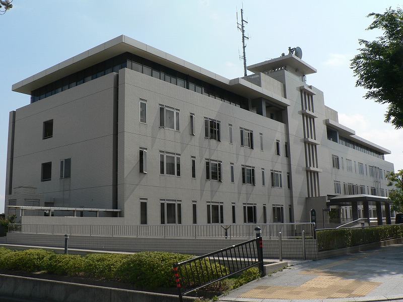
Photo: 田英, Public domain.
Kanan is a town located in Minamikawachi District, Osaka Prefecture, Japan. As of 1 January 2022, the town had an estimated population of 15,429 and a population density of 610 persons per km2. The total area of the town is 25.26 square kilometres. Kanan is situated 8 km northeast of Gatsurinji Temple.
Minami
Suburb
Minami-ku is a ward of the city of Sakai in Osaka Prefecture, Japan. The ward has an area of 40.44 km2 and a population of 155,266. The population density is 3,839 per km2. Minami is situated 9 km northwest of Gatsurinji Temple.
Gatsurinji Temple
- Type: Buddhist temple
- Categories: place of worship and religion
- Location: Kawachinagano, Osaka, Kansai, Japan, East Asia, Asia
- View on OpenStreetMap
Latitude
34.44025° or 34° 26′ 25″ northLongitude
135.56929° or 135° 34′ 10″ eastOpen location code
8Q6QCHR9+3POpenStreetMap ID
node 5345875810OpenStreetMap feature
amenity=place_of_worship
This page is based on OpenStreetMap, Wikidata, and Wikimedia Commons.
We’d love your help improving our open data sources. Thank you for contributing.
Satellite Map
Discover Gatsurinji Temple from above in high-definition satellite imagery.
Notable Places Nearby
Highlights include 瑠璃殿 and Former Mikkaichi Koban.
Nearby Places
Explore places such as 月輪寺木造薬師如来坐像 and 地蔵菩薩.
Osaka: Must-Visit Destinations
Delve into Osaka, Sakai, Kansai International Airport, and Suita.
Curious Buddhist Temples to Discover
Uncover intriguing Buddhist temples from every corner of the globe.
About Mapcarta. Data © OpenStreetMap contributors and available under the Open Database License". Text is available under the CC BY-SA 4.0 license, except for photos, directions, and the map. Photo: 663highland, CC BY 2.5.