Transdev - Carcavelos
Transdev - Carcavelos is a bus stop in O. Azeméis, Riba-Ul, Ul, Macinhata da Seixa, Madail, Oliveira de Azeméis Municipality, Aveiro District. Transdev - Carcavelos is situated nearby to the square Largo de Carcavelos, as well as near the church Capela do Senhor da Campa.| Tap on a place to explore it |
Places of Interest Nearby
Highlights include Santiago de Riba - Ul railway halt and Couto de Cucujães railway halt.
Santiago de Riba - Ul railway halt
Railway stop

Photo: Wikimedia, Public domain.
Santiago de Riba - Ul railway halt is a railway stop, which is situated 540 metres south of Transdev - Carcavelos.
Couto de Cucujães railway halt
Railway station
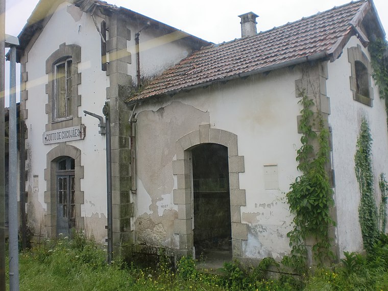
Photo: JP Ribeiro, CC BY-SA 4.0.
Couto de Cucujães railway halt is a railway station, which is situated 1½ km northwest of Transdev - Carcavelos.
Oliveira de Azeméis railway station
Railway station

Photo: JP Ribeiro, CC BY-SA 4.0.
Oliveira de Azeméis railway station is situated 2 km south of Transdev - Carcavelos.
Places in the Area
Nearby places include Vila de Cucujães and Ul (Oliveira de Azeméis).

Ul (Oliveira de Azeméis)
Village

Photo: Vitor Oliveira, CC BY-SA 2.0.
Oliveira de Azeméis, Santiago de Riba-Ul, Ul, Macinhata da Seixa e Madail is a civil parish in the municipality of Oliveira de Azeméis in Porto Metropolitan Area, Portugal. Ul (Oliveira de Azeméis) is situated 3½ km south of Transdev - Carcavelos.
Travanca
Village

Photo: Wikimedia, CC BY-SA 4.0.
Travanca is a village, which is situated 4½ km south of Transdev - Carcavelos.
Transdev - Carcavelos
Latitude
40.8558° or 40° 51′ 21″ northLongitude
-8.48718° or 8° 29′ 14″ westOpen location code
8CGHVG47+84OpenStreetMap ID
node 5347106971OpenStreetMap feature
highway=bus_stopOpenStreetMap feature
public_transport=platform
This page is based on OpenStreetMap, Wikidata, and Wikimedia Commons.
We’d love your help improving our open data sources. Thank you for contributing.
Satellite Map
Discover Transdev - Carcavelos from above in high-definition satellite imagery.
Notable Places Nearby
Highlights include Largo de Carcavelos and Capela do Senhor da Campa.
Nearby Places
Explore places such as Transdev - Carcavelos and Casa de Carcavelos.
Portugal: Must-Visit Destinations
Delve into Lisbon, Caldas da Rainha, Porto, and Coimbra.
Curious Bus Stops to Discover
Uncover intriguing bus stops from every corner of the globe.
About Mapcarta. Data © OpenStreetMap contributors and available under the Open Database License". Text is available under the CC BY-SA 4.0 license, except for photos, directions, and the map. Photo: Tsy1980, CC BY-SA 4.0.