Lille Bondekirke
Lille Bondekirke is an archaeological site in Guldborgsund Municipality, Region Zealand. Lille Bondekirke is situated nearby to the archaeological site Store Bondekirke, as well as near Birkemosehøjene.| Tap on a place to explore it |
Places of Interest Nearby
Highlights include Valnæsgård and Vålse Church.
Valnæsgård
Manor estate

Photo: Bo Mertz, CC BY-SA 2.0.
Valnæsgård, formerly Egensegaard, is a manor house and estate located on the northwestern tip of Falster, 20 km northwest of Nykøbing Falster in southeastern Denmark. Valnæsgård is situated 2 km south of Lille Bondekirke.
Vålse Church
Church
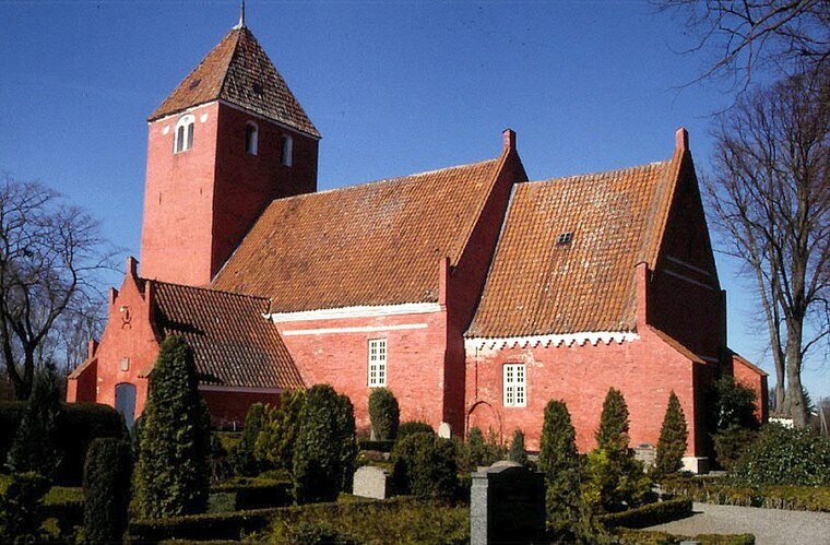
Photo: Wikimedia, CC BY-SA 2.5.
Vålse Church is situated 3½ km southeast of Lille Bondekirke.
Places in the Area
Nearby places include Orehoved and Øster Kippinge.
Orehoved
Village

Photo: Wikimedia, Public domain.
Orehoved is a small harbour town in the north of the Danish island of Falster. It grew up mainly as a result of the railway and ferry services in the late 19th century. As of 2025, it has a population of 426. Orehoved is situated 7 km east of Lille Bondekirke.
Øster Kippinge
Village

Photo: Wikimedia, CC BY-SA 2.5.
Øster Kippinge is a village 6 kilometres west of Nørre Alslev on the Danish island of Falster. As of 2025, it has a population of 269. Øster Kippinge is situated 7 km southeast of Lille Bondekirke.
Gåbense
Hamlet

Photo: Dannebrog Spy, CC BY-SA 4.0.
Gåbense is a hamlet, which is situated 8 km east of Lille Bondekirke.
Lille Bondekirke
- Type: Archaeological site
- Description: ancient monument in Denmark (2572)
- Categories: dolmen, historic site, tourist attraction, and tourism
- Location: Guldborgsund Municipality, Region Zealand, Denmark, Nordic countries, Europe
- View on OpenStreetMap
Latitude
54.95603° or 54° 57′ 22″ northLongitude
11.75052° or 11° 45′ 2″ eastOpen location code
9F6HXQ42+C6OpenStreetMap ID
node 5405662346OpenStreetMap feature
historic=archaeological_siteWikidata ID
Q30108676
This page is based on OpenStreetMap, Wikidata, and Wikimedia Commons.
We’d love your help improving our open data sources. Thank you for contributing.
Satellite Map
Discover Lille Bondekirke from above in high-definition satellite imagery.
In Other Languages
From Bavarian to Swedish—“Lille Bondekirke” goes by many names.
- Bavarian: “Lille Bondekirke”
- Danish: “Lille Bondekirke”
- French: “Lille Bondekirke”
- German: “Lille Bondekirke”
- Swedish: “Lille Bondekirke”
Notable Places Nearby
Highlights include Store Bondekirke and Birkemosehøjene.
Nearby Places
Explore places such as Skovly and Orehøjgård.
Denmark: Must-Visit Destinations
Delve into Copenhagen, Aarhus, Odense, and Aalborg.
Curious Archaeological Sites to Discover
Uncover intriguing archaeological sites from every corner of the globe.
About Mapcarta. Data © OpenStreetMap contributors and available under the Open Database License". Text is available under the CC BY-SA 4.0 license, except for photos, directions, and the map. Photo: Inkey, CC BY 2.0.