Arena Næstved
Arena Næstved is a fast food restaurant in Næstved Municipality, Region Zealand. Arena Næstved is situated nearby to Næstved Stadium, as well as near the sports venue Næstved Hallerne.| Tap on a place to explore it |
Places of Interest Nearby
Highlights include Næstved Stadium and Næstved Townhall.
Næstved Stadium
Stadium
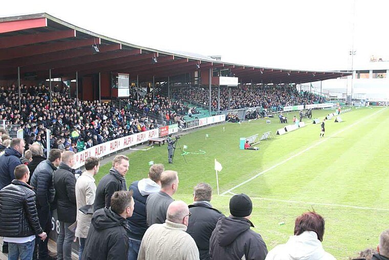
Photo: Henrik St Larsen, CC BY-SA 4.0.
Næstved Stadium is a multi-use stadium in Næstved, Denmark. It is known as MTM Service Park for sponsorship reasons. It is currently only used for football matches and is the home stadium of Næstved BK. Næstved Stadium is situated 150 metres east of Arena Næstved.
Næstved Townhall
Town hall

Photo: Toxophilus, CC BY-SA 4.0.
Næstved Townhall is situated 680 metres north of Arena Næstved.
Næstved railway station
Railway station
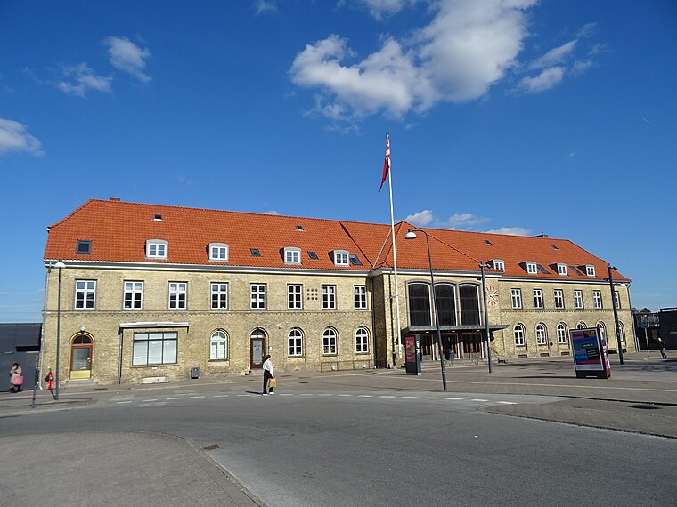
Photo: Dannebrog Spy, CC BY-SA 4.0.
Næstved railway station is the main railway station serving the town of Næstved in southern Zealand, Denmark. It is located in the centre of the town, on the eastern edge of the historic town centre, and immediately adjacent to the Næstved bus station. Næstved railway station is situated 1 km north of Arena Næstved.
Places in the Area
Nearby places include Næstved and Rønnebæk.
Næstved

Photo: Mads Sabroe, CC BY-SA 3.0.
Næstved is a town in the municipality of the same name, located in the southern part of the island of Zealand in Denmark. Næstved has several adult education centers, five elementary schools - and has at least one of each type of the four upper-second-level education centers.
Rønnebæk
Village

Photo: Bococo, CC BY-SA 3.0.
Rønnebæk is a village and small satellite community to Næstved, with a population of 592, in Næstved Municipality, Region Zealand in Denmark. It is located 5 km southeast of central Næstved. Rønnebæk is situated 3 km east of Arena Næstved.
Næstelsø
Hamlet

Photo: Bococo, CC BY-SA 3.0.
Næstelsø is a hamlet, which is situated 5 km east of Arena Næstved.
Arena Næstved
- Type: Fast food restaurant
- Categories: food and restaurant
- Location: Næstved Municipality, Region Zealand, Denmark, Nordic countries, Europe
- View on OpenStreetMap
Latitude
55.22329° or 55° 13′ 24″ northLongitude
11.76351° or 11° 45′ 49″ eastOpen location code
9F7H6QF7+8COpenStreetMap ID
node 5418514638OpenStreetMap feature
amenity=fast_food
This page is based on OpenStreetMap, Wikidata, and Wikimedia Commons.
We’d love your help improving our open data sources. Thank you for contributing.
Satellite Map
Discover Arena Næstved from above in high-definition satellite imagery.
Notable Places Nearby
Highlights include Næstved Hallerne and Næstved Stadion.
Nearby Places
Explore places such as Næstved Arena and Bellis.
Denmark: Must-Visit Destinations
Delve into Copenhagen, Aarhus, Odense, and Aalborg.
Curious Fast Food Restaurants to Discover
Uncover intriguing fast food restaurants from every corner of the globe.
About Mapcarta. Data © OpenStreetMap contributors and available under the Open Database License". Text is available under the CC BY-SA 4.0 license, except for photos, directions, and the map. Photo: Inkey, CC BY 2.0.