Wystawa ‘Schron’
Wystawa ‘Schron’ is a museum in Lubań, Lower Silesian Voivodeship. Wystawa ‘Schron’ is situated nearby to Park Niepodległości, as well as near the town hall Urząd Miasta Lubań.| Tap on a place to explore it |
Places of Interest Nearby
Highlights include Lubań town hall and Polish-Saxon Post Milestone in Lubań.
Lubań town hall
Town hall
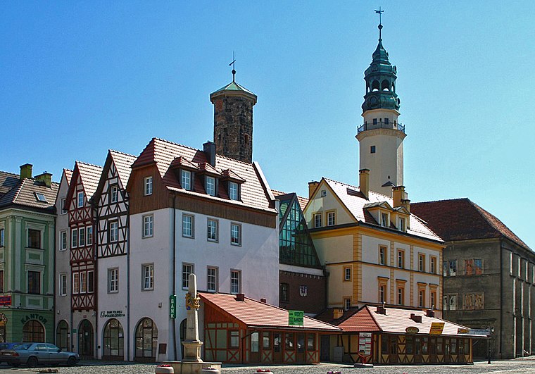
Photo: Hydrus, Public domain.
Lubań town hall is situated 200 metres north of Wystawa ‘Schron’.
Polish-Saxon Post Milestone in Lubań
Historic site
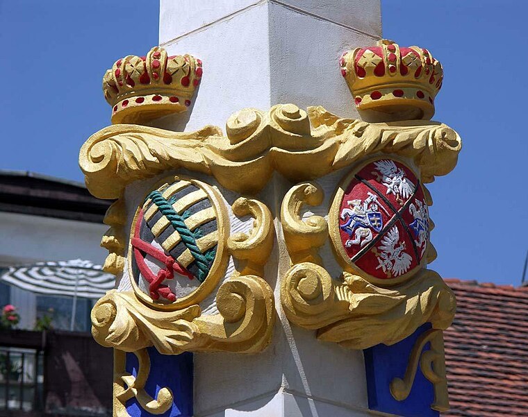
Photo: Wikimedia, CC BY-SA 2.0.
Polish-Saxon Post Milestone in Lubań is a historic site, which is situated 270 metres north of Wystawa ‘Schron’.
Virgin Mary Lutheran Church in Lubań
Church

Photo: Czajkaczechowa, CC BY-SA 3.0 pl.
Virgin Mary Lutheran Church in Lubań is situated 340 metres south of Wystawa ‘Schron’.
Places in the Area
Nearby places include Jałowiec and Kościelnik.
Jałowiec
Village

Photo: SchiDD, CC BY-SA 3.0.
Jałowiec is a village in the administrative district of Gmina Lubań, within Lubań County, Lower Silesian Voivodeship, in south-western Poland. Prior to 1945 it was in Germany and had the name Wingendorf. Jałowiec is situated 3 km southeast of Wystawa ‘Schron’.
Kościelnik
Village

Photo: Czajkaczechowa, CC BY-SA 3.0 pl.
Kościelnik is a village in the administrative district of Gmina Lubań, within Lubań County, Lower Silesian Voivodeship, in south-western Poland. Kościelnik is situated 3½ km south of Wystawa ‘Schron’.
Zaręba
Village

Photo: Rosa77, CC BY-SA 3.0 pl.
Zaręba is a village in the administrative district of Gmina Siekierczyn, within Lubań County, Lower Silesian Voivodeship, in south-western Poland. Zaręba is situated 4 km west of Wystawa ‘Schron’.
Wystawa ‘Schron’
- Type: Museum
- Categories: tourism and tourist attraction
- Location: Lubań, Lubań County, Lower Silesian Voivodeship, Poland, Central Europe, Europe
- View on OpenStreetMap
Latitude
51.11813° or 51° 7′ 5″ northLongitude
15.28963° or 15° 17′ 23″ eastOperator
Stowarzyszenie Miłośników Górnych ŁużycOpen location code
9F3Q479Q+6VOpenStreetMap ID
node 5430122524OpenStreetMap feature
tourism=museum
This page is based on OpenStreetMap, Wikidata, and Wikimedia Commons.
We’d love your help improving our open data sources. Thank you for contributing.
Satellite Map
Discover Wystawa ‘Schron’ from above in high-definition satellite imagery.
Notable Places Nearby
Highlights include Urząd Miasta Lubań and Park Niepodległości.
Nearby Places
Explore places such as Dyby and Wieża Bracka.
Lower Silesian Voivodeship: Must-Visit Destinations
Delve into Wrocław, Legnica, Wałbrzych, and Głogów.
Curious Museums to Discover
Uncover intriguing museums from every corner of the globe.
About Mapcarta. Data © OpenStreetMap contributors and available under the Open Database License". Text is available under the CC BY-SA 4.0 license, except for photos, directions, and the map. Photo: Sicherlich, CC BY 3.0.