STUDIO A-Sh
STUDIO A-Sh is a school in Kita-ku, Osaka, Osaka. STUDIO A-Sh is situated nearby to the hospital 北野病院西館, as well as near the shrine Honden.| Tap on a place to explore it |
Places of Interest Nearby
Highlights include Taiyū-ji and Temma.
Taiyū-ji
Buddhist temple

Photo: Naokijp, CC BY-SA 4.0.
Taiyū-ji is a Buddhist temple in Osaka Prefecture, Japan. It was founded in 821. Taiyū-ji is situated 280 metres southwest of STUDIO A-Sh.
Temma
Railway station
Temma Station is a railway station on the Osaka Loop Line in Osaka, Osaka Prefecture, Japan. Temma is situated 610 metres east of STUDIO A-Sh.
Ōsaka Station
Railway station
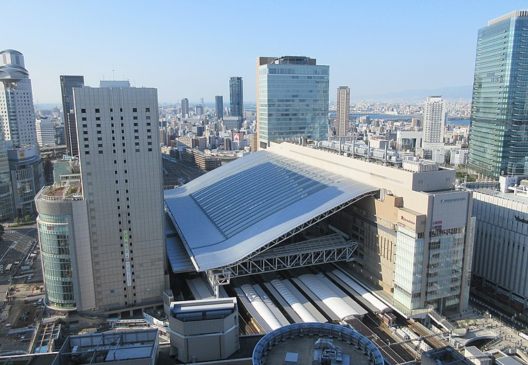
Photo: KishujiRapid, CC BY-SA 4.0.
Ōsaka Station is a major railway station in the Umeda district of Kita-ku, Osaka, Japan, operated by West Japan Railway Company. It forms as one of the city's main railway terminals to the north, the other being Shin-Ōsaka. Ōsaka Station is situated 1 km west of STUDIO A-Sh.
Places in the Area
Nearby places include Doyamacho and Kita.
Doyamacho
Neighborhood

Photo: Path-x21, CC BY-SA 4.0.
Dōyamachō is a district in the Umeda area of Osaka, Japan. It is close to the JR Osaka and Umeda Station, many restaurants, bars, izakaya, karaoke, massage parlors, host clubs, hotels, and shops concentrate in the area.
Kita

Photo: Martin Abegglen, CC BY-SA 2.0.
The Kita is the newest centre of Osaka city. The area around Umeda station, where major terminals for the Osaka subway, Japan Rail, Hankyu and Hanshin railways can be found, boasts department stores, buildings full of fashionable shops and various attractions.

STUDIO A-Sh
Latitude
34.70402° or 34° 42′ 15″ northLongitude
135.50577° or 135° 30′ 21″ eastOpen location code
8Q6QPG34+J8OpenStreetMap ID
node 5472015323OpenStreetMap feature
amenity=school
This page is based on OpenStreetMap, Wikidata, and Wikimedia Commons.
We’d love your help improving our open data sources. Thank you for contributing.
Satellite Map
Discover STUDIO A-Sh from above in high-definition satellite imagery.
Notable Places Nearby
Highlights include 北野病院西館 and Honden.
Nearby Places
Explore places such as 山西福祉記念会館 and サッチェズカリー.
Osaka: Must-Visit Destinations
Delve into Toyonaka, Osaka castle, Bay Area, and Universal Studios Japan.
Curious Places to Discover
Uncover intriguing places from every corner of the globe.
About Mapcarta. Data © OpenStreetMap contributors and available under the Open Database License". Text is available under the CC BY-SA 4.0 license, except for photos, directions, and the map. Photo: Martin Abegglen, CC BY-SA 2.0.