Löschgruppe Lüttelbracht
Löschgruppe Lüttelbracht is a fire station in Brüggen, Viersen, North Rhine-Westphalia. Löschgruppe Lüttelbracht is situated nearby to the church St. Maria Helferin, as well as near the lake Borner See.| Tap on a place to explore it |
Places of Interest Nearby
Highlights include Brüggen Castle and Saint Peter Church.
Brüggen Castle
Public building

Photo: sodele, CC BY-SA 2.0.
Brüggen Castle is a water castle in the southeastern part of the Lower Rhine municipality of Brüggen in North Rhine-Westphalia. It was the most important castle in the north of the Duchy of Jülich. Brüggen Castle is situated 2 km southwest of Löschgruppe Lüttelbracht.
Saint Peter Church
Church
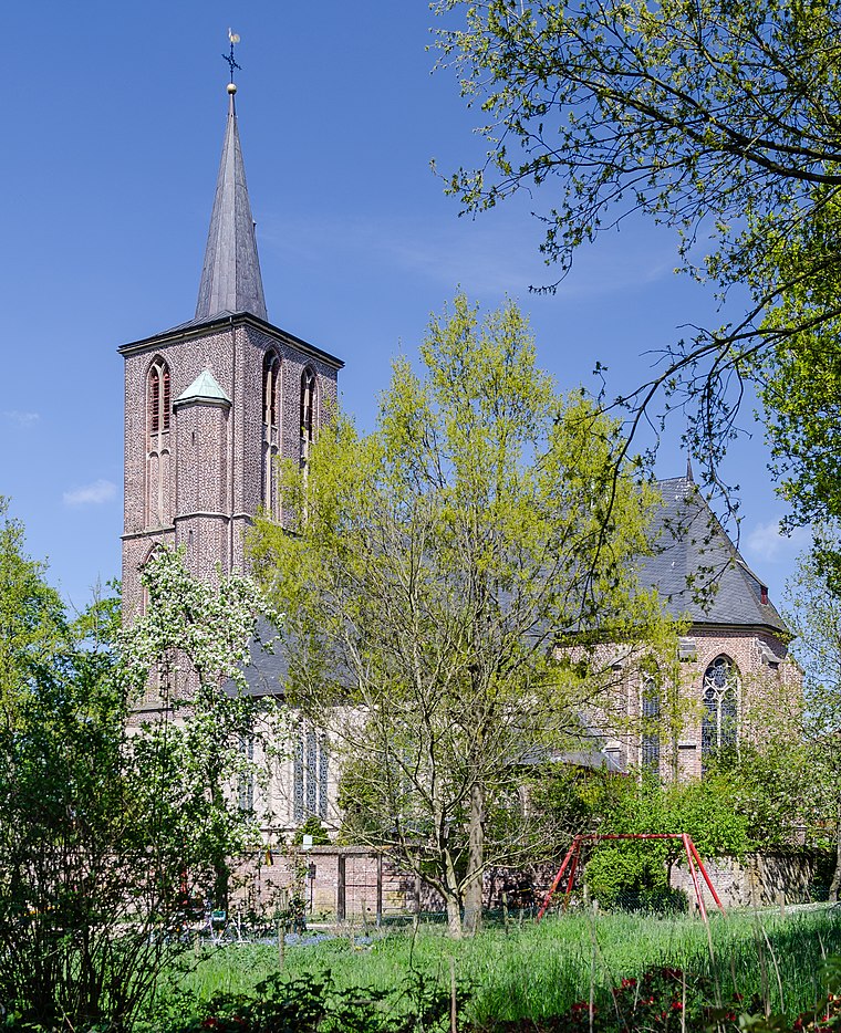
Photo: Tuxyso, CC BY-SA 3.0.
Saint Peter Church is situated 2 km southeast of Löschgruppe Lüttelbracht.

Places in the Area
Nearby places include Brempt and Elmpt.
Brempt
Village

Photo: Wikimedia, Public domain.
Brempt is a village, which is situated 5 km south of Löschgruppe Lüttelbracht.
Elmpt
Village

Photo: Ichmichi, CC BY-SA 3.0.
Elmpt is a village, which is situated 6 km southwest of Löschgruppe Lüttelbracht.
Niederkrüchten
Town

Photo: Ichmichi, CC BY-SA 3.0.
Niederkrüchten is a municipality in the district of Viersen, in North Rhine-Westphalia, Germany. It is situated approximately 15 km east of Roermond in the Netherlands and 15 km west of Mönchengladbach. Niederkrüchten is situated 7 km south of Löschgruppe Lüttelbracht.
Löschgruppe Lüttelbracht
- Type: Fire station
- Location: Brüggen, Viersen, Düsseldorf, North Rhine-Westphalia, Germany, Central Europe, Europe
- View on OpenStreetMap
Latitude
51.25856° or 51° 15′ 31″ northLongitude
6.19847° or 6° 11′ 55″ eastOperator
Freiwillige Feuerwehr BrüggenOpen location code
9F38755X+C9OpenStreetMap ID
node 5477420127OpenStreetMap feature
amenity=fire_station
This page is based on OpenStreetMap, Wikidata, and Wikimedia Commons.
We’d love your help improving our open data sources. Thank you for contributing.
Satellite Map
Discover Löschgruppe Lüttelbracht from above in high-definition satellite imagery.
Notable Places Nearby
Highlights include St. Maria Helferin and Elektro-Pferde-Reitbahn.
Nearby Places
Explore places such as Gemeindekindergarten Lüttelbracht and Lüttelbracht Kirche.
North Rhine-Westphalia: Must-Visit Destinations
Delve into Cologne, Düsseldorf, Bonn, and Dortmund.
Curious Fire Stations to Discover
Uncover intriguing fire stations from every corner of the globe.
About Mapcarta. Data © OpenStreetMap contributors and available under the Open Database License". Text is available under the CC BY-SA 4.0 license, except for photos, directions, and the map. Photo: Daniel Schwen, CC BY-SA 2.5.