Bezirksdienst Anrath/Neersen
Bezirksdienst Anrath/Neersen is a police station in Willich, Viersen, North Rhine-Westphalia. Bezirksdienst Anrath/Neersen is situated nearby to the government office Stadtteilbüro, as well as near the fountain Brunnen.| Tap on a place to explore it |
Places of Interest Nearby
Highlights include Saint John the Baptist Church and Haus Stockum.
Saint John the Baptist Church
Church

Photo: Ichmichi, CC BY-SA 3.0.
Saint John the Baptist Church is situated 150 metres northeast of Bezirksdienst Anrath/Neersen.
Haus Stockum
Castle

Photo: Wikimedia, CC BY-SA 3.0 de.
Haus Stockum is a castle, which is situated 1½ km southwest of Bezirksdienst Anrath/Neersen.
Haus Broich
School building

Photo: LuBo76, CC BY-SA 4.0.
Haus Broich is a school building, which is situated 2 km east of Bezirksdienst Anrath/Neersen.
Places in the Area
Nearby places include Anrath and Vennheide.


Neersen
Suburb
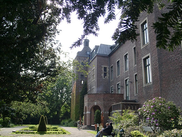
Photo: Historiograf, CC BY 2.0.
Neersen is a suburb, which is situated 3 km southeast of Bezirksdienst Anrath/Neersen.
Bezirksdienst Anrath/Neersen
- Opening hours:
Tuesday: 5:00 PM—6:00 PM
Thursday: 10:00 AM—11:00 AM - Type: Police station
- Location: Willich, Viersen, Düsseldorf, North Rhine-Westphalia, Germany, Central Europe, Europe
- View on OpenStreetMap
Latitude
51.27767° or 51° 16′ 40″ northLongitude
6.46116° or 6° 27′ 40″ eastOperator
Polizei ViersenOpen location code
9F387FH6+3FOpenStreetMap ID
node 5480409523OpenStreetMap feature
amenity=police
This page is based on OpenStreetMap, Wikidata, and Wikimedia Commons.
We’d love your help improving our open data sources. Thank you for contributing.
Satellite Map
Discover Bezirksdienst Anrath/Neersen from above in high-definition satellite imagery.
Notable Places Nearby
Highlights include Brunnen and Stadtteilbüro.
Nearby Places
Explore places such as Uwe Lünger and Stinges Anrath 2.
North Rhine-Westphalia: Must-Visit Destinations
Delve into Cologne, Düsseldorf, Bonn, and Dortmund.
Curious Police Stations to Discover
Uncover intriguing police stations from every corner of the globe.
About Mapcarta. Data © OpenStreetMap contributors and available under the Open Database License". Text is available under the CC BY-SA 4.0 license, except for photos, directions, and the map. Photo: Daniel Schwen, CC BY-SA 2.5.