Stitz-Bildstock
Stitz-Bildstock is a church in Voitsberg, Styria. Stitz-Bildstock is situated nearby to the pitch Sportanlage Trainingsplatz, as well as near the fire station FF Voitsberg.| Tap on a place to explore it |
Places of Interest Nearby
Highlights include Burg Obervoitsberg and Gustav-Adolf-Kirche Voitsberg.
Burg Obervoitsberg
Castle
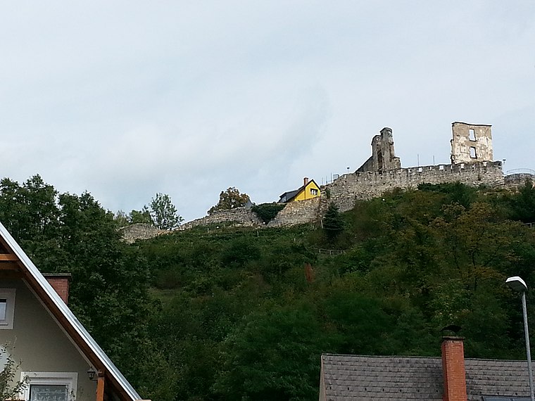
Photo: Liuthalas, CC BY-SA 3.0 at.
Burg Obervoitsberg is a castle in Voitsberg, Styria, Austria. Burg Obervoitsberg is situated 1¼ km northwest of Stitz-Bildstock.
Gustav-Adolf-Kirche Voitsberg
Church

Photo: Wikimedia, CC BY-SA 3.0 at.
Gustav-Adolf-Kirche Voitsberg is a church, which is situated 1¼ km west of Stitz-Bildstock.
Filialkirche hl. Michael, Voitsberg
Church

Photo: Liuthalas, CC BY-SA 3.0 at.
Filialkirche hl. Michael, Voitsberg is a church, which is situated 1¼ km west of Stitz-Bildstock.
Places in the Area
Nearby places include Piberegg and Södingberg.
Piberegg
Village
Piberegg is a former municipality in the district of Voitsberg in the Austrian state of Styria. Since the 2015 Styria municipal structural reform, it is part of the municipality Bärnbach. Piberegg is situated 7 km northwest of Stitz-Bildstock.
Södingberg
Village
Södingberg is a former municipality in the district of Voitsberg in the Austrian state of Styria. Since the 2015 Styria municipal structural reform, it is part of the municipality Geistthal-Södingberg. Södingberg is situated 7 km north of Stitz-Bildstock.
Österreich
Hamlet

Photo: Liuthalas, CC BY-SA 4.0.
Österreich is a hamlet, which is situated 9 km east of Stitz-Bildstock.
Stitz-Bildstock
- Type: Church
- Categories: place of worship and religion
- Location: Voitsberg, Voitsberg District, Styria, Austria, Central Europe, Europe
- View on OpenStreetMap
Latitude
47.04603° or 47° 2′ 46″ northLongitude
15.1643° or 15° 9′ 52″ eastOpen location code
8FVQ25W7+CPOpenStreetMap ID
node 5513876798OpenStreetMap feature
amenity=place_of_worship
This page is based on OpenStreetMap, Wikidata, and Wikimedia Commons.
We’d love your help improving our open data sources. Thank you for contributing.
Satellite Map
Discover Stitz-Bildstock from above in high-definition satellite imagery.
Notable Places Nearby
Highlights include Sportanlage Trainingsplatz and FF Voitsberg.
Nearby Places
Explore places such as Dr. Albert Johann Kalkhofer and Pumpstation Fripertingerstr..
Styria: Must-Visit Destinations
Delve into Graz, Leoben, Bruck an der Mur, and Kapfenberg.
Curious Churches to Discover
Uncover intriguing churches from every corner of the globe.
About Mapcarta. Data © OpenStreetMap contributors and available under the Open Database License". Text is available under the CC BY-SA 4.0 license, except for photos, directions, and the map. Photo: Kmarka, CC BY-SA 3.0.