Rocha Amarela
Rocha Amarela is a peak in Alte, Loulé, Faro District and has an elevation of 314 metres. Rocha Amarela is situated nearby to the hamlet Esteval dos Mouros, as well as near Júlia.| Tap on a place to explore it |
Places of Interest
Highlights include Igreja de Nossa Senhora da Assunção, matriz de Alte and Alte Waterfall.
Igreja de Nossa Senhora da Assunção, matriz de Alte
Church

Photo: Wikimedia, CC BY-SA 3.0.
Igreja de Nossa Senhora da Assunção, matriz de Alte is a church.

Places in the Area
Nearby places include Alte and Querença, Tôr e Benafim.
Alte
Village

Photo: OsvaldoGago, CC BY-SA 3.0.
Alte is a village and civil parish in the municipality of Loulé, in the Algarve region in the south of Portugal. The population in 2011 was 1,997, in an area of 94.33 square kilometres.
Querença, Tôr e Benafim
Village
Querença, Tôr e Benafim is a civil parish in the municipality of Loulé, Portugal. It was formed in 2013 by the merger of the former parishes Querença, Tôr and Benafim. The population in 2011 was 2,713, in an area of 102.18 km².
Paderne
Village
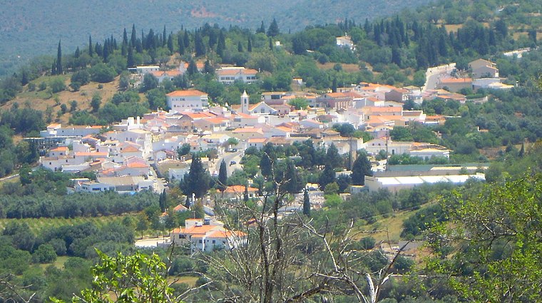
Photo: Creative Commons, CC BY-SA 4.0.
Paderne is a village and civil parish in the municipality of Albufeira, in the Portuguese region of Algarve. The population in 2011 was 3,304, in an area of 52.56 km2.
Rocha Amarela
- Type: Peak with an elevation of 314 metres
- Category: landform
- Location: Alte, Loulé, Faro District, Algarve, Portugal, Iberia, Europe
- View on OpenStreetMap
Latitude
37.2188° or 37° 13′ 8″ northLongitude
-8.1692° or 8° 10′ 9″ westElevation
314 metres (1,030 feet)Open location code
8C9H6R9J+G8OpenStreetMap ID
node 5584335961OpenStreetMap feature
natural=peak
This page is based on OpenStreetMap, Wikidata, and Wikimedia Commons.
We’d love your help improving our open data sources. Thank you for contributing.
Satellite Map
Discover Rocha Amarela from above in high-definition satellite imagery.
Localities in the Area
Explore places such as Rocha Amarela and Esteval dos Mouros.
Notable Places Nearby
Highlights include Largo Amadeu Pedro da Cruz and Mercado de Alte.
Algarve: Must-Visit Destinations
Delve into Faro, Portimão, Lagos, and Tavira.
Curious Peaks to Discover
Uncover intriguing peaks from every corner of the globe.
About Mapcarta. Data © OpenStreetMap contributors and available under the Open Database License". Text is available under the CC BY-SA 4.0 license, except for photos, directions, and the map. Photo: Michael Gaylard, CC BY 2.0.