Favrenghøj
Favrenghøj is an archaeological site in Varde Municipality, Region of Southern Denmark. Favrenghøj is situated nearby to the village Sig, as well as near Horne.| Tap on a place to explore it |
Places of Interest Nearby
Highlights include Thorstrup Church and Sig railway station.
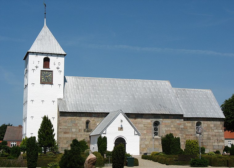
Thorstrup Church
Church

Photo: Erik Bachmann, CC BY-SA 3.0.
Thorstrup Church is situated 2½ km east of Favrenghøj.
Sig railway station
Railway stop
 Sig station is a railway station serving the village of Sig near Varde in West Jutland, Denmark. Sig station is located on the Esbjerg–Struer railway line from Esbjerg to Struer. Sig railway station is situated 3½ km southeast of Favrenghøj.
Places in the Area
Nearby places include Sig and Horne.
Tistrup
Village
 Tistrup is a town in southwestern Jutland in the Varde Municipality, in Region of Southern Denmark. As of 1 January 2025, it has a population of 1,437. Tistrup is situated 6 km northeast of Favrenghøj.
Favrenghøj
- Type: Archaeological site
- Description: ancient monument in Varde Municipality (79164)
- Categories: tumulus, historic site, tourist attraction, and tourism
- Location: Varde Municipality, Region of Southern Denmark, Denmark, Nordic countries, Europe
- View on OpenStreetMap
Latitude
55.68275° or 55° 40′ 58″ northLongitude
8.53318° or 8° 31′ 59″ eastOpen location code
9F7CMGMM+47OpenStreetMap ID
node 5627348073OpenStreetMap feature
historic=archaeological_siteWikidata ID
Q30141497
This page is based on OpenStreetMap, Wikidata, and Wikimedia Commons.
We’d love your help improving our open data sources. Thank you for contributing.
Satellite Map
Discover Favrenghøj from above in high-definition satellite imagery.
In Other Languages
“Favrenghøj” goes by many names.
- Danish: “Favrenghøj”
Notable Places Nearby
Highlights include Horshøj and MOT-Multi.
Nearby Places
Explore places such as Bjerggårde and West Brew.
Denmark: Must-Visit Destinations
Delve into Copenhagen, Aarhus, Odense, and Aalborg.
Curious Archaeological Sites to Discover
Uncover intriguing archaeological sites from every corner of the globe.
About Mapcarta. Data © OpenStreetMap contributors and available under the Open Database License". Text is available under the CC BY-SA 4.0 license, except for photos, directions, and the map. Photo: Wikimedia, CC BY-SA 3.0.