Buch / Hohackerwald
Buch / Hohackerwald is in Gruibingen, Göppingen, Baden-Württemberg. Buch / Hohackerwald is situated nearby to the swimming pool Planschbecken, as well as near the water park Freibad Bad Boll.| Tap on a place to explore it |
Places of Interest Nearby
Highlights include Teufelsloch-Kaltenwang and Stiftskirche St. Cyriakus.
Teufelsloch-Kaltenwang
Nature reserve

Photo: Aristeas, CC BY-SA 4.0.
Teufelsloch-Kaltenwang is a nature reserve.
Stiftskirche St. Cyriakus
Church
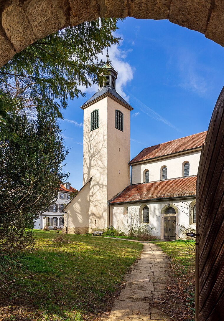
Photo: Aristeas, CC BY-SA 4.0.
Stiftskirche St. Cyriakus is a church, which is situated 1½ km north of Buch / Hohackerwald.
Kornberg
Peak

Photo: CatalpaSpirit, CC BY-SA 4.0.
Kornberg is a mountain located in the Gruibingen municipality of the Göppingen district, Baden-Württemberg, Germany. It is 778.2 m high and part of the Northern rim of the Swabian Jura.
Places in the Area
Nearby places include Aichelberg and Pliensbach.
Aichelberg
Village
Aichelberg is a municipality in the district of Göppingen in Baden-Württemberg in southern Germany. Aichelberg is between Stuttgart and Ulm at the Albaufstieg, the slope of the Swabian Jura in 357–615 meters altitude. Aichelberg is situated 3½ km west of Buch / Hohackerwald.
Pliensbach
Hamlet
Pliensbach is a hamlet in the municipality of Zell unter Aichelberg in the district of Göppingen in central Baden-Württemberg. Pliensbach is situated 3½ km northwest of Buch / Hohackerwald.
Zell unter Aichelberg
Village

Photo: LkGoeppingen, Public domain.
Zell unter Aichelberg is a municipality in the district of Göppingen in Baden-Württemberg in southern Germany. Zell unter Aichelberg is situated 3½ km northwest of Buch / Hohackerwald.
Buch / Hohackerwald
- Type: Sign
- Categories: information and tourism
- Location: Gruibingen, Göppingen, Stuttgart, Baden-Württemberg, Germany, Central Europe, Europe
- View on OpenStreetMap
Latitude
48.62662° or 48° 37′ 36″ northLongitude
9.61107° or 9° 36′ 40″ eastElevation
574 metres (1,883 feet)Operator
Landkreis GöppingenOpen location code
8FWFJJG6+JCOpenStreetMap ID
node 5647979711OpenStreetMap feature
tourism=information
This page is based on OpenStreetMap, Wikidata, and Wikimedia Commons.
We’d love your help improving our open data sources. Thank you for contributing.
Satellite Map
Discover Buch / Hohackerwald from above in high-definition satellite imagery.
Notable Places Nearby
Highlights include Planschbecken and Freibad Bad Boll.
Nearby Places
Explore places such as Karlshütte and Waldschäden in Bad Boll?.
Baden-Württemberg: Must-Visit Destinations
Delve into Stuttgart, Heidelberg, Karlsruhe, and Mannheim.
Curious Places to Discover
Uncover intriguing places from every corner of the globe.
About Mapcarta. Data © OpenStreetMap contributors and available under the Open Database License". Text is available under the CC BY-SA 4.0 license, except for photos, directions, and the map. Photo: Traveler100, CC BY-SA 3.0.