Fanø Cykler
Fanø Cykler is a shop in Fanø, Region of Southern Denmark. Fanø Cykler is situated nearby to Fanø Strandgalleri, as well as near the cemetery Søndre Kirkegård.| Tap on a place to explore it |
Places of Interest Nearby
Highlights include Nordby Church.
Nordby Church
Church
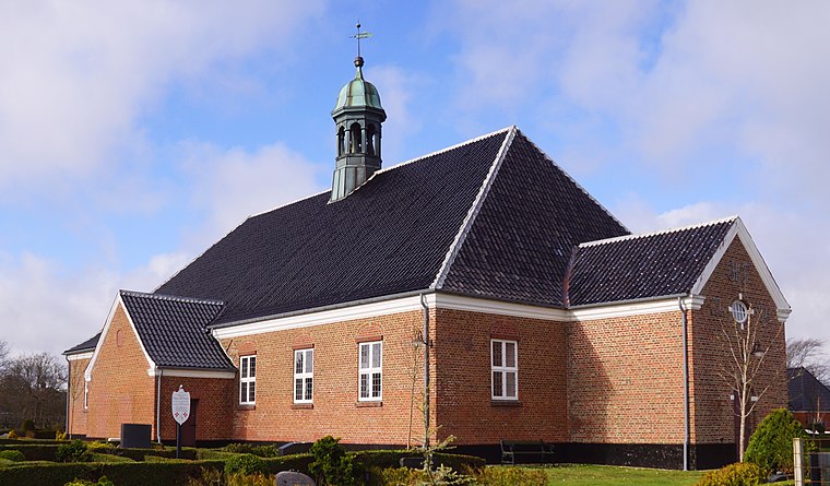
Photo: Wolfgang Pehlemann, CC BY-SA 3.0 de.
Nordby Church is situated 2½ km northeast of Fanø Cykler.
Places in the Area
Nearby places include Nordby and Esbjerg.
Nordby
Village

Photo: Hubertus45, CC BY 2.5.
Nordby is a Danish town, seat of the Fanø Municipality, in the Region of Southern Denmark. The population was 2,629 as of 1 January 2025. Nordby is situated 3 km north of Fanø Cykler.
Esbjerg

Photo: Taxiarchos228, FAL.
Esbjerg is a city in Southwestern Jutland. The town was once Denmark's biggest fishing harbour, and the harbour is still an economic driving force in the town.
Jerne
Suburb

Photo: Flickr, CC BY-SA 2.0.
Jerne is a suburb, which is situated 9 km northeast of Fanø Cykler.
Fanø Cykler
- Opening hours: 9:00 AM—1:00 PM
- Type: Shop
- Category: bike rental
- Location: Fanø, Region of Southern Denmark, Denmark, Nordic countries, Europe
- View on OpenStreetMap
Latitude
55.4216° or 55° 25′ 18″ northLongitude
8.37932° or 8° 22′ 46″ eastOperator
Fanø CyklerOpen location code
9F7CC9CH+JPOpenStreetMap ID
node 5661411761OpenStreetMap feature
amenity=bicycle_rentalOpenStreetMap feature
shop=rental
This page is based on OpenStreetMap, Wikidata, and Wikimedia Commons.
We’d love your help improving our open data sources. Thank you for contributing.
Satellite Map
Discover Fanø Cykler from above in high-definition satellite imagery.
Notable Places Nearby
Highlights include Fanø Strandgalleri and Søndre Kirkegård.
Nearby Places
Explore places such as Stoppestedet and Rindby Supermarked Bager.
Denmark: Must-Visit Destinations
Delve into Copenhagen, Aarhus, Odense, and Aalborg.
Curious Shops to Discover
Uncover intriguing shops from every corner of the globe.
About Mapcarta. Data © OpenStreetMap contributors and available under the Open Database License". Text is available under the CC BY-SA 4.0 license, except for photos, directions, and the map. Photo: Ragnar1904, CC BY-SA 4.0.