Cleveland Ave & Jack Gibbs Blvd
Cleveland Ave & Jack Gibbs Blvd is a bus stop in City of Columbus, Franklin, Ohio. Cleveland Ave & Jack Gibbs Blvd is situated nearby to the police station Columbus State Police Department, as well as near the neighborhood Fort Hayes.| Tap on a place to explore it |
Places of Interest Nearby
Highlights include Nationwide Arena and Columbus Museum of Art.
Nationwide Arena
Stadium
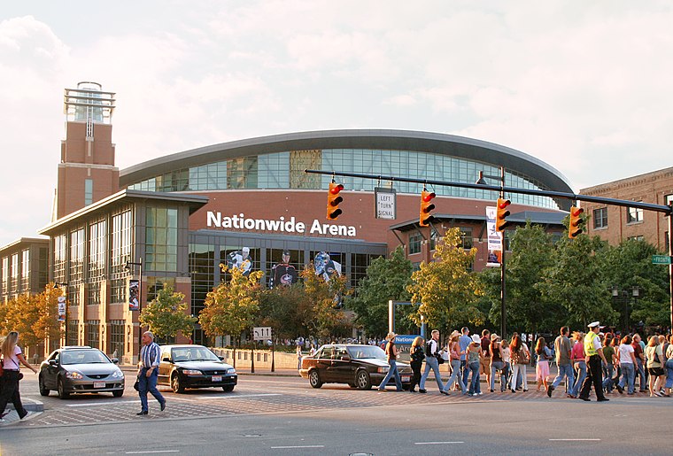
Photo: Tysto, Public domain.
Nationwide Arena is a multi-purpose arena in the Arena District of Columbus, Ohio, United States. Since completion in 2000, the arena has served as the home of the Columbus Blue Jackets of the National Hockey League. Nationwide Arena is situated 1 mile west of Cleveland Ave & Jack Gibbs Blvd.
Columbus Museum of Art
Museum

Photo: Indrian, CC BY-SA 3.0.
The Columbus Museum of Art is an art museum in downtown Columbus, Ohio. Formed in 1878 as the Columbus Gallery of Fine Arts, it was the first art museum to register its charter with the state of Ohio. Columbus Museum of Art is situated 3,000 feet south of Cleveland Ave & Jack Gibbs Blvd.
Saint Patrick Church
Church

Photo: Nheyob, CC BY-SA 4.0.
Saint Patrick Church is a historic building and the second-oldest Catholic church building in Columbus, Ohio. Located in the Discovery District neighborhood, the structure served as the pro-cathedral of the Roman Catholic Diocese of Columbus until the consecration of Saint Joseph Cathedral. Saint Patrick Church is situated 1,500 feet south of Cleveland Ave & Jack Gibbs Blvd.
Places in the Area
Nearby places include Fort Hayes and Discovery District.
Fort Hayes
Neighborhood

Photo: Nyttend, Public domain.
Fort Hayes was a military post in Columbus, Ohio, United States. Created by an act of the United States Congress on July 11, 1862, the site was also known as the Columbus Arsenal until 1922, when the site was renamed after former Ohio Governor and later 19th U.S. President Rutherford B.
Discovery District
Neighborhood

Photo: LongestAugust, Public domain.
The Discovery District is a special improvement district in downtown Columbus, Ohio, the home of Columbus State Community College, Columbus College of Art and Design, Columbus Museum of Art, and Columbus Metropolitan Library.
King-Lincoln Bronzeville
Neighborhood
King-Lincoln Bronzeville is a historically African American neighborhood in Columbus, Ohio. Originally known as Bronzeville by the residents of the community, it was renamed the King-Lincoln District by Mayor Michael B.
Cleveland Ave & Jack Gibbs Blvd
- Type: Bus stop
- Category: transportation
- Location: City of Columbus, Franklin, Ohio, Midwest, United States, North America
- View on OpenStreetMap
Latitude
39.97257° or 39° 58′ 21″ northLongitude
-82.99012° or 82° 59′ 24″ westOperator
Central Ohio Transit AuthorityOpen location code
86FVX2F5+2XOpenStreetMap ID
node 5711236517OpenStreetMap feature
highway=bus_stopOpenStreetMap feature
public_transport=platform
This page is based on OpenStreetMap, Wikidata, and Wikimedia Commons.
We’d love your help improving our open data sources. Thank you for contributing.
Satellite Map
Discover Cleveland Ave & Jack Gibbs Blvd from above in high-definition satellite imagery.
Notable Places Nearby
Highlights include Columbus State Police Department and Columbus Hall.
Nearby Places
Explore places such as 427 Cleveland Ave and Columbus Bakery.
Ohio: Must-Visit Destinations
Delve into Columbus, Cincinnati, Cleveland, and Bowling Green.
Curious Bus Stops to Discover
Uncover intriguing bus stops from every corner of the globe.
About Mapcarta. Data © OpenStreetMap contributors and available under the Open Database License". Text is available under the CC BY-SA 4.0 license, except for photos, directions, and the map. Photo: Wikimedia, CC0.