Tannboden
Tannboden is in Horgen, Canton of Zurich. Tannboden is situated nearby to Dampflok ‘Tigerli’, as well as near Summstein.| Tap on a place to explore it |
Places of Interest Nearby
Highlights include Albis and Sihlwald railway station.
Albis
Ridge

Photo: Parpan05, CC BY-SA 3.0.
The Albis is a chain of hills in the Canton of Zürich, Switzerland.
Sihlwald railway station
Railway station

Photo: Parpan05, CC BY-SA 3.0.
Sihlwald is a railway station in the Sihl Valley, in the municipality of Horgen, Canton of Zurich, Switzerland. The station is on the Sihltal line, which is operated by the Sihltal Zürich Uetliberg Bahn. Sihlwald railway station is situated 1 km northeast of Tannboden.
Bürglen
Peak
The Bürglen is the highest mountain of the Albis, a wooded range stretching west of Lake Zurich in the Swiss canton of Zurich. It is located between Hausen am Albis and the valley of the Sihl.
Places in the Area
Nearby places include Hausen am Albis and Oberrieden.
Hausen am Albis
Village

Photo: Leandros, Public domain.
Hausen am Albis is a municipality in the district of Affoltern in the canton of Zürich in Switzerland.
Oberrieden
Village
Oberrieden is a municipality in the district of Horgen in the canton of Zurich in Switzerland. It is one of the towns along the south shore of Lake Zurich. Oberrieden is situated 2½ km northeast of Tannboden.
Langnau am Albis
Village
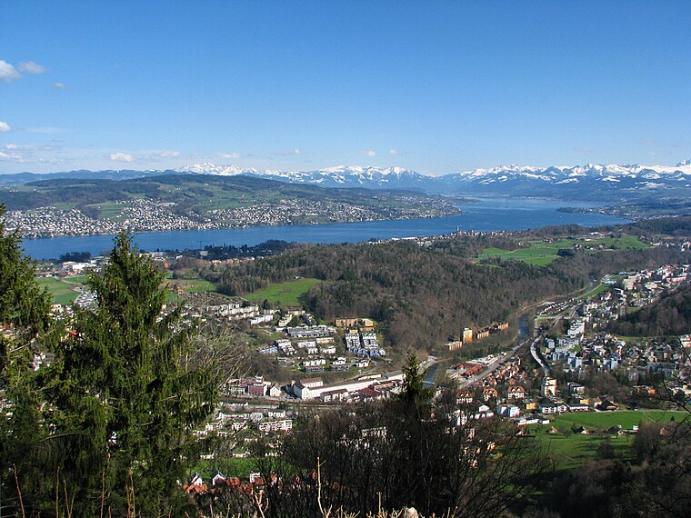
Photo: Roland zh, CC BY-SA 3.0.
Langnau am Albis is a village in the district of Horgen in the canton of Zürich in Switzerland. Langnau am Albis is situated 3 km north of Tannboden.
Tannboden
- Type: Sign
- Categories: information and tourism
- Location: Horgen, Horgen District, Canton of Zurich, Switzerland, Central Europe, Europe
- View on OpenStreetMap
Latitude
47.26139° or 47° 15′ 41″ northLongitude
8.55213° or 8° 33′ 8″ eastElevation
601 metres (1,972 feet)Operator
Zürcher WanderwegeOpen location code
8FVC7H62+HVOpenStreetMap ID
node 5715637029OpenStreetMap feature
tourism=information
This page is based on OpenStreetMap, Wikidata, and Wikimedia Commons.
We’d love your help improving our open data sources. Thank you for contributing.
Satellite Map
Discover Tannboden from above in high-definition satellite imagery.
Places with the Same Name
Discover other places named “Tannboden”.
Notable Places Nearby
Highlights include Dampflok ‘Tigerli’ and Summstein.
Nearby Places
Explore places such as Wildnispark Zürich Sihlwald and Wildnispark Zürich.
Switzerland: Must-Visit Destinations
Delve into Zurich, Berne, Geneva, and Basel.
Curious Places to Discover
Uncover intriguing places from every corner of the globe.
About Mapcarta. Data © OpenStreetMap contributors and available under the Open Database License". Text is available under the CC BY-SA 4.0 license, except for photos, directions, and the map. Photo: Wikimedia, CC0.