Vale da Igreja
Vale da Igreja is a bus stop in Odiáxere, Lagos, Faro District. Vale da Igreja is situated nearby to the post office CTT correios Odiaxere, as well as near the peak Palmares.| Tap on a place to explore it |
Places of Interest Nearby
Highlights include Lagos Station and Odiáxere halt.
Lagos Station
Railway station
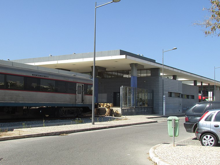
Photo: Creative Commons, CC BY-SA 4.0.
The Lagos railway station is the western terminus of the Algarve line, which serves the city of Lagos, in the Faro District, in Portugal. It opened on the 7th of July 1922. The building was replaced by a new structure in 2003. Lagos Station is situated 4 km south of Vale da Igreja.
Odiáxere halt
Railway station

Photo: Bextrel, CC BY-SA 4.0.
Odiáxere is a closed halt on the Algarve line in the Lagos municipality, Portugal. It was opened on the 30th of July 1922, and closed in 2003. At the time, the halt had an average of 20 passengers per month. Odiáxere halt is situated 3½ km east of Vale da Igreja.
Meia Praia halt
Railway stop
Meia Praia is a halt on the Algarve Line in the Lagos municipality, Portugal. Meia Praia halt is situated 3 km southeast of Vale da Igreja.
Places in the Area
Nearby places include Mexilhoeira Grande and Bairro de Casas para Famílias Pobres em Lagos.
Mexilhoeira Grande
Town

Photo: Bextrel, CC BY-SA 4.0.
Mexilhoeira Grande is a civil parish in the municipality of Portimão in the southern Portuguese region of the Algarve. The population in 2011 was 4,029, in an area of 91.15 km². Mexilhoeira Grande is situated 4½ km northeast of Vale da Igreja.
Bairro de Casas para Famílias Pobres em Lagos
Neighborhood

Photo: Ajpvalente, CC BY-SA 4.0.
Bairro de Casas para Famílias Pobres em Lagos is a neighborhood, which is situated 4½ km south of Vale da Igreja.
Bairro de Santo Amaro I
Neighborhood

Photo: Bextrel, CC BY-SA 4.0.
Bairro de Santo Amaro I is a neighborhood, which is situated 4½ km south of Vale da Igreja.
Vale da Igreja
- Type: Bus stop
- Category: transportation
- Location: Odiáxere, Lagos, Faro District, Algarve, Portugal, Iberia, Europe
- View on OpenStreetMap
Latitude
37.14305° or 37° 8′ 35″ northLongitude
-8.66218° or 8° 39′ 44″ westOpen location code
8C9H48VQ+64OpenStreetMap ID
node 5752390479OpenStreetMap feature
highway=bus_stopOpenStreetMap feature
public_transport=platform
This page is based on OpenStreetMap, Wikidata, and Wikimedia Commons.
We’d love your help improving our open data sources. Thank you for contributing.
Satellite Map
Discover Vale da Igreja from above in high-definition satellite imagery.
Places with the Same Name
Discover other places named “Vale da Igreja”.
Notable Places Nearby
Highlights include CTT correios Odiaxere and Destacamento de Trânsito de Lagos.
Nearby Places
Explore places such as Vale da Igreja and Sunny Shade Sails.
Algarve: Must-Visit Destinations
Delve into Faro, Portimão, Tavira, and Albufeira.
Curious Bus Stops to Discover
Uncover intriguing bus stops from every corner of the globe.
About Mapcarta. Data © OpenStreetMap contributors and available under the Open Database License". Text is available under the CC BY-SA 4.0 license, except for photos, directions, and the map. Photo: Jose A., CC BY 2.0.