Site de Polignac
Site de Polignac is in Polignac, Arrondissement du Puy-en-Velay, Auvergne-Rhône-Alpes. Site de Polignac is situated nearby to the motorhome stopover Aire camping-cars à Polignac, as well as near the public building salle communale.| Tap on a place to explore it |
Places of Interest Nearby
Highlights include Château de Polignac and Mont Denise.
Château de Polignac
Castle

Photo: Wikijoe, Public domain.
Château de Polignac is a castle, which is situated 1 km east of Site de Polignac.

Église Saint-Martin de Polignac
Church

Photo: MOSSOT, CC BY-SA 3.0.
Église Saint-Martin de Polignac is a church, which is situated 1 km northeast of Site de Polignac.
Places in the Area
Nearby places include Espaly-Saint-Marcel and Aiguilhe.
Espaly-Saint-Marcel
Village

Photo: Wikimedia, CC BY-SA 3.0.
Espaly-Saint-Marcel is a commune in the Haute-Loire department in south-central France. Espaly-Saint-Marcel is situated 2½ km southeast of Site de Polignac.
Aiguilhe
Village
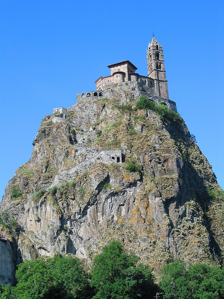
Photo: Jean-Pol GRANDMONT, CC BY 3.0.
Aiguilhe is a commune in the Haute-Loire department in south-central France. Aiguilhe is close to Le Puy-en-Velay, and famous for the Saint Michel chapel. Raymond of Aguilers was from here. Aiguilhe is situated 3½ km southeast of Site de Polignac.
Ceyssac
Village

Photo: Wikimedia, CC BY-SA 4.0.
Ceyssac is a commune in the Haute-Loire department of south-central France. Ceyssac is situated 3½ km south of Site de Polignac.
Site de Polignac
- Type: Sign
- Categories: information and tourism
- Location: Polignac, Arrondissement du Puy-en-Velay, Haute-Loire, Auvergne-Rhône-Alpes, France, Europe
- View on OpenStreetMap
Latitude
45.06737° or 45° 4′ 3″ northLongitude
3.84991° or 3° 50′ 60″ eastOpen location code
8FQ53R8X+WXOpenStreetMap ID
node 5759040705OpenStreetMap feature
tourism=information
This page is based on OpenStreetMap, Wikidata, and Wikimedia Commons.
We’d love your help improving our open data sources. Thank you for contributing.
Satellite Map
Discover Site de Polignac from above in high-definition satellite imagery.
Notable Places Nearby
Highlights include Aire camping-cars à Polignac and salle communale.
Nearby Places
Explore places such as Visitez la Forteresse de Polignac and Croix des Scouts et Guides d’Europe.
Auvergne-Rhône-Alpes: Must-Visit Destinations
Delve into Lyon, Grenoble, Clermont-Ferrand, and Saint-Étienne.
Curious Places to Discover
Uncover intriguing places from every corner of the globe.
About Mapcarta. Data © OpenStreetMap contributors and available under the Open Database License". Text is available under the CC BY-SA 4.0 license, except for photos, directions, and the map. Photo: Pedelecs, CC BY-SA 3.0.