Zone Z
Zone Z is a bus stop in Fingal, Leinster. Zone Z is situated nearby to Dardistown Cemetery, as well as near the golf course Pitch and Putt.| Tap on a place to explore it |
Places of Interest Nearby
Highlights include Santry and Belcamp Park.
Santry
Stadium

Photo: Peter Gerken, CC BY-SA 2.0.
Morton Stadium, or the National Athletics Stadium, is an athletics stadium in Santry Demesne, Santry in Ireland. Often called Santry Stadium, it is the centre for athletics events in Dublin city and the home track of Clonliffe Harriers. Santry is situated 2 km southwest of Zone Z.
Belcamp Park
Park
Belcamp Park is a public park in Clonshaugh, Dublin 17, within the broad Coolock area, near Darndale and Priorswood. The park runs south of the N32, along the northern boundary of the city. Belcamp Park is situated 1½ km southeast of Zone Z.
Turning Point
Work of art
 Turning Point is a work of art, which is situated 1½ km northwest of Zone Z.
Places in the Area
Nearby places include Santry and Beaumont.
Santry
Suburb

Photo: Peter Gerken, CC BY-SA 2.0.
Santry is a suburb on the northside of Dublin, Ireland, bordering Coolock, Glasnevin, Kilmore and Ballymun. It straddles the boundary of Dublin City Council and Fingal County Council jurisdictions.
Beaumont
Suburb
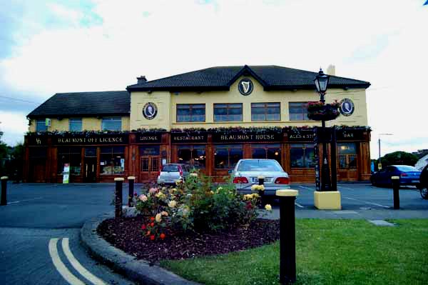
Photo: sarah gallagher, CC BY-SA 2.0.
Beaumont is a northside suburb of Dublin city, Ireland, bordered by Donnycarney, Santry and Artane. It lies within the postal district of Dublin 9. Beaumont is situated 3½ km south of Zone Z.
Coolock
Suburb

Photo: Rwxrwxrwx, CC BY-SA 3.0.
Coolock is a large suburban area, centred on a village, on Dublin city's Northside in Ireland. Coolock is crossed by the Santry River, a prominent feature in the middle of the district, with a linear park and ponds. Coolock is situated 3½ km southeast of Zone Z.
Zone Z
- Type: Bus stop
- Category: transportation
- Location: Fingal, Leinster, Ireland, Britain and Ireland, Europe
- View on OpenStreetMap
Latitude
53.41466° or 53° 24′ 53″ northLongitude
-6.22724° or 6° 13′ 38″ westOperator
Dublin Airport AuthorityNetwork
Express Red Car Park ShuttleOpen location code
9C5MCQ7F+V4OpenStreetMap ID
node 5780455670OpenStreetMap feature
highway=bus_stopOpenStreetMap feature
public_transport=platform
This page is based on OpenStreetMap, Wikidata, and Wikimedia Commons.
We’d love your help improving our open data sources. Thank you for contributing.
Satellite Map
Discover Zone Z from above in high-definition satellite imagery.
Places with the Same Name
Discover other places named “Zone Z”.
Notable Places Nearby
Highlights include Dardistown Cemetery and Pitch and Putt.
Nearby Places
Explore places such as Express Red Long Term Car Park Y & Z and Zone Y.
Ireland: Must-Visit Destinations
Delve into Dublin, Cork, Limerick, and Galway.
Curious Bus Stops to Discover
Uncover intriguing bus stops from every corner of the globe.
About Mapcarta. Data © OpenStreetMap contributors and available under the Open Database License". Text is available under the CC BY-SA 4.0 license, except for photos, directions, and the map. Photo: Wikimedia, CC BY-SA 3.0.