IRSS
IRSS is a college in Guipavas, Arrondissement de Brest, Brittany. IRSS is situated nearby to the college Centre National de la Fonction Publique Territoriale CNFPT, as well as near the church El Bethel.| Tap on a place to explore it |
Places of Interest Nearby
Highlights include Stade Francis-Le Blé and Vallon du Stangalar.
Stade Francis-Le Blé
Stadium

Photo: Brestois029200, CC BY-SA 3.0.
The Stade Francis-Le Blé, formerly known as the Stade de l'Armoricaine, is a multi-use stadium in Brest, France. It is currently used mostly for football matches and is the home stadium of Stade Brestois 29. Stade Francis-Le Blé is situated 1½ km south of IRSS.
Vallon du Stangalar
Park

Photo: Citron, CC BY-SA 3.0.
Vallon du Stangalar is a park, which is situated 1½ km southeast of IRSS.
Brest station
Railway station
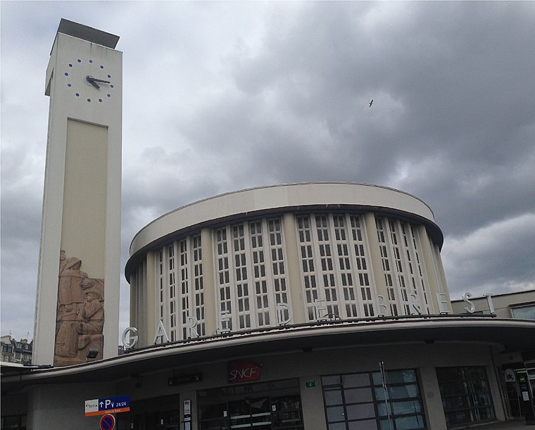
Photo: AirScott, CC BY-SA 4.0.
Brest station is the railway station serving Brest, France. It is the western terminus of the Paris–Brest railway. The new station, built above the town's harbour in 1932 on the site of its 1865 predecessor, includes a tall clock tower and a semi circle passenger hall. Brest station is situated 3½ km southwest of IRSS.
Places in the Area
Nearby places include Saint-Marc and Brest.

Brest

Photo: Inkey, CC BY-SA 2.5.
Brest is a city on the west Atlantic coast of France. It has a long history of navigation. There are very large tides here.
Porte Tourville
Locality

Photo: Wikimedia, CC BY-SA 4.0.
Porte Tourville is a locality, which is situated 4½ km southwest of IRSS.
IRSS
- Opening hours:
Monday—Friday: 7:45 AM—12:30 PM
Wednesday: closed - Type: College
- Category: education
- Location: Guipavas, Arrondissement de Brest, Finistère, Brittany, France, Europe
- View on OpenStreetMap
Latitude
48.41783° or 48° 25′ 4″ northLongitude
-4.461° or 4° 27′ 40″ westOpen location code
8CWQCG9Q+4JOpenStreetMap ID
node 5799390553OpenStreetMap feature
amenity=college
This page is based on OpenStreetMap, Wikidata, and Wikimedia Commons.
We’d love your help improving our open data sources. Thank you for contributing.
Satellite Map
Discover IRSS from above in high-definition satellite imagery.
Places with the Same Name
Discover other places named “IRSS”.
Notable Places Nearby
Highlights include Centre National de la Fonction Publique Territoriale CNFPT and El Bethel.
Nearby Places
Explore places such as Centre d’activité Le Foch and Le Lotus Bleu.
Brittany: Must-Visit Destinations
Delve into Rennes, Brest, Finistère, and Morbihan.
Curious Colleges to Discover
Uncover intriguing colleges from every corner of the globe.
About Mapcarta. Data © OpenStreetMap contributors and available under the Open Database License". Text is available under the CC BY-SA 4.0 license, except for photos, directions, and the map. Photo: Spendeau, CC BY-SA 3.0.