La Fulonnière
La Fulonnière is a hamlet in Saint-Jean-du-Corail-des-Bois, Arrondissement of Avranches, Normandy. La Fulonnière is situated nearby to the hamlet La Pichardière, as well as near La Blaitière.| Tap on a place to explore it |
Places of Interest
Highlights include Église Saint-Jean-Baptiste de Saint-Jean-du-Corail-des-Bois and Église Saint-Pierre des Loges-sur-Brécey.
Église Saint-Jean-Baptiste de Saint-Jean-du-Corail-des-Bois
Church

Photo: ChBougui, CC BY-SA 4.0.
Église Saint-Jean-Baptiste de Saint-Jean-du-Corail-des-Bois is a church.
Église Saint-Pierre des Loges-sur-Brécey
Church

Photo: ChBougui, CC BY-SA 4.0.
Église Saint-Pierre des Loges-sur-Brécey is a church.
Église Saint-Nicolas de Saint-Nicolas-des-Bois
Church

Photo: ChBougui, CC BY-SA 4.0.
Église Saint-Nicolas de Saint-Nicolas-des-Bois is a church.
Places in the Area
Nearby places include Rouffigny and Sainte-Cécile.
Rouffigny
Village

Photo: Xfigpower, CC BY-SA 3.0.
Rouffigny is a former commune in the Manche department in Normandy in north-western France. On 1 January 2016, it was merged into the new commune of Villedieu-les-Poêles-Rouffigny. Rouffigny is situated 5 km northwest of La Fulonnière.
Sainte-Cécile
Village

Photo: Ikmo-ned, CC BY-SA 3.0.
Sainte-Cécile is a commune in the Manche department in Normandy in north-western France. Sainte-Cécile is situated 7 km north of La Fulonnière.
Le Parc
Village
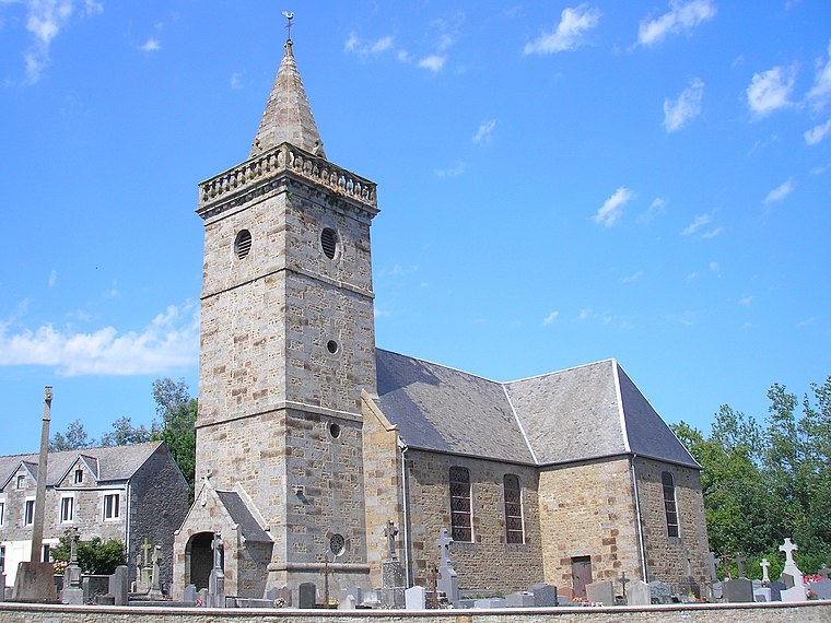
Photo: Ikmo-ned, CC BY-SA 4.0.
Le Parc is a commune in the department of Manche, northwestern France. It was established on 1 January 2016 by merger of the former communes of Braffais, Plomb and Sainte-Pience. Le Parc is situated 7 km west of La Fulonnière.
La Fulonnière
- Type: Hamlet
- Category: locality
- Location: Saint-Jean-du-Corail-des-Bois, Arrondissement of Avranches, Manche, Normandy, France, Europe
- View on OpenStreetMap
Latitude
48.77289° or 48° 46′ 22″ northLongitude
-1.19598° or 1° 11′ 46″ westOpen location code
8CWWQRF3+5JOpenStreetMap ID
node 5823867026OpenStreetMap feature
place=hamlet
This page is based on OpenStreetMap, Wikidata, and Wikimedia Commons.
We’d love your help improving our open data sources. Thank you for contributing.
Satellite Map
Discover La Fulonnière from above in high-definition satellite imagery.
Localities in the Area
Explore places such as La Fulonnière and La Pichardière.
Notable Places Nearby
Highlights include Réservoir de Saint-Nicolas and Mairie de Saint-Jean-du-Corail-des-Bois.
Normandy: Must-Visit Destinations
Delve into Orne, Rouen, Seine-Maritime, and Le Havre.
Curious Hamlets to Discover
Uncover intriguing hamlets from every corner of the globe.
About Mapcarta. Data © OpenStreetMap contributors and available under the Open Database License". Text is available under the CC BY-SA 4.0 license, except for photos, directions, and the map. Photo: Inkey, CC BY-SA 3.0.