Pont de Charbonnier
Pont de Charbonnier is in Chazeaux, Arrondissement of Largentière, Auvergne-Rhône-Alpes. Pont de Charbonnier is situated nearby to the church Église Saint-André de Chazeaux, as well as near the town hall Mairie de Chazeaux.| Tap on a place to explore it |
Places of Interest Nearby
Highlights include Église Saint-André de Chazeaux and Chapelle Notre-Dame-de-Bon-Rencontre de Joux.
Église Saint-André de Chazeaux
Church

Photo: FredSeiller, CC BY-SA 4.0.
Église Saint-André de Chazeaux is a church, which is situated 760 metres northwest of Pont de Charbonnier.
Chapelle Notre-Dame-de-Bon-Rencontre de Joux
Church

Photo: Kakoula10, CC BY-SA 4.0.
Chapelle Notre-Dame-de-Bon-Rencontre de Joux is a church, which is situated 1½ km southwest of Pont de Charbonnier.
Église Saint-André d’Ailhon
Church

Photo: Patrice78500, CC BY-SA 3.0.
Église Saint-André d’Ailhon is a church, which is situated 2½ km northeast of Pont de Charbonnier.
Places in the Area
Nearby places include Lentillères and Chassiers.
Lentillères
Village

Photo: Vpe, CC BY-SA 3.0.
Lentillères is a commune in the Ardèche department in southern France. Lentillères is situated 2½ km north of Pont de Charbonnier.
Chassiers
Village

Photo: Vpe, CC BY-SA 3.0.
Chassiers is a commune in the Ardèche department in southern France. Chassiers is situated 4½ km south of Pont de Charbonnier.
Lachapelle-sous-Aubenas
Village
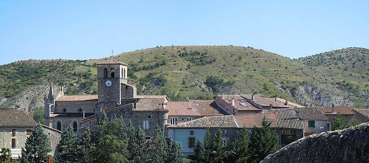
Photo: Patrice78500, CC BY-SA 3.0.
Lachapelle-sous-Aubenas is a commune in the Ardèche department in southern France. Lachapelle-sous-Aubenas is situated 4½ km southeast of Pont de Charbonnier.
Pont de Charbonnier
- Type: Sign
- Categories: information and tourism
- Location: Chazeaux, Arrondissement of Largentière, Ardèche and Drôme, Auvergne-Rhône-Alpes, France, Europe
- View on OpenStreetMap
Latitude
44.58904° or 44° 35′ 21″ northLongitude
4.31578° or 4° 18′ 57″ eastElevation
313 metres (1,027 feet)Open location code
8FP6H8Q8+J8OpenStreetMap ID
node 5846756043OpenStreetMap feature
tourism=information
This page is based on OpenStreetMap, Wikidata, and Wikimedia Commons.
We’d love your help improving our open data sources. Thank you for contributing.
Satellite Map
Discover Pont de Charbonnier from above in high-definition satellite imagery.
Notable Places Nearby
Highlights include Mairie de Chazeaux and Col de Bonne Rencontre.
Nearby Places
Explore places such as La Coste and Chazeaux.
Ardèche and Drôme: Must-Visit Destinations
Delve into Die, Vallon-Pont-d’Arc, Buis-les-Baronnies, and Lagorce.
Curious Places to Discover
Uncover intriguing places from every corner of the globe.
About Mapcarta. Data © OpenStreetMap contributors and available under the Open Database License". Text is available under the CC BY-SA 4.0 license, except for photos, directions, and the map. Photo: Perreal, CC BY-SA 3.0.