Peter Houses (End of route)
Peter Houses (End of route) is a bus stop in Santiago de Cuba, Eastern Cuba. Peter Houses (End of route) is situated nearby to the place of worship Iglesia Torre Fuerte, as well as near the police station Puesto de PNR.| Tap on a place to explore it |
Places in the Area
Nearby places include El Caney and Siboney.
El Caney
Suburb
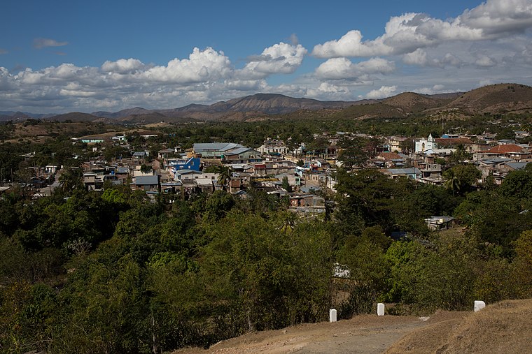
Photo: Christian Pirkl, CC BY-SA 4.0.
El Caney is a small village six kilometers to the northeast of Santiago, Cuba. "Caney" means longhouse in Taíno. El Caney is situated 6 km north of Peter Houses (End of route).
Siboney
Village

Photo: Christian Pirkl, CC BY-SA 4.0.
Siboney is a Cuban village and consejo popular located in the east of the city of Santiago de Cuba and belonging to its municipality. Siboney is situated 7 km southeast of Peter Houses (End of route).
Peter Houses (End of route)
- Type: Bus stop
- Also known as: “A8 (Fin de Ruta)”
- Category: transportation
- Location: Santiago de Cuba, Santiago de Cuba Province, Eastern Cuba, Cuba, Caribbean, North America
- View on OpenStreetMap
Latitude
20.0012° or 20° 0′ 4″ northLongitude
-75.7617° or 75° 45′ 42″ westOpen location code
77G6262Q+F8OpenStreetMap ID
node 5854901921OpenStreetMap feature
highway=bus_stopOpenStreetMap feature
public_transport=platform
This page is based on OpenStreetMap, Wikidata, and Wikimedia Commons.
We’d love your help improving our open data sources. Thank you for contributing.
Satellite Map
Discover Peter Houses (End of route) from above in high-definition satellite imagery.
Notable Places Nearby
Highlights include Iglesia Torre Fuerte and Puesto de PNR.
Nearby Places
Explore places such as Fin de ruta and Inicio de ruta.
Eastern Cuba: Must-Visit Destinations
Delve into Guantánamo, Guantánamo Bay, Holguín, and Alejandro de Humboldt National Park.
Curious Bus Stops to Discover
Uncover intriguing bus stops from every corner of the globe.
About Mapcarta. Data © OpenStreetMap contributors and available under the Open Database License". Text is available under the CC BY-SA 4.0 license, except for photos, directions, and the map. Photo: Rastapopulous, CC BY-SA 3.0.