Signone - Canal Puy
Signone - Canal Puy is a quarter in Avignon, Vaucluse, Provence-Alpes-Côte d’Azur. Signone - Canal Puy is situated nearby to the neighborhood Résidence Les jardins de Clarisse, as well as near the quarter Avignon Sud.| Tap on a place to explore it |
Places of Interest
Highlights include Avignon–Provence Airport and Parc des Sports.
Avignon–Provence Airport
Aerodrome

Photo: jean-louis Zimmermann, CC BY 2.0.
Avignon–Provence Airport is an airport located in the city of Avignon and 4 kilometres west of Caumont-sur-Durance, in the Vaucluse department of the Provence-Alpes-Côte d'Azur region in France.
Parc des Sports
Stadium

Photo: Véronique PAGNIER, Public domain.
Parc des Sports is a multi-purpose stadium in Avignon, France. It is currently used mostly for football matches and hosts the home matches of AC Avignonnais. The capacity of the stadium is 17,518 spectators. Parc des Sports is situated 3 km northwest of Signone - Canal Puy.
Notre-Dame de Bon Repos
Church

Photo: Wikimedia, CC BY-SA 3.0.
Notre-Dame de Bon Repos is a church, which is situated 2½ km north of Signone - Canal Puy.
Places in the Area
Nearby places include Châteaurenard and Rognonas.
Châteaurenard
Town

Photo: Wikimedia, CC BY-SA 3.0.
Châteaurenard is a commune in the Arles arrondissement, in the Bouches-du-Rhône department, in the Provence-Alpes-Côte d'Azur region, in southern France. Châteaurenard is situated 3½ km south of Signone - Canal Puy.
Rognonas
Village
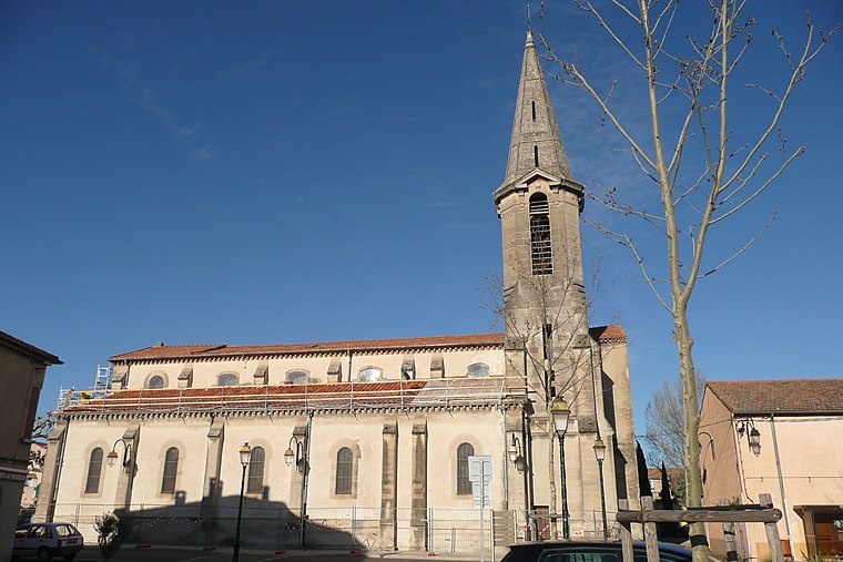
Photo: Wikimedia, CC BY-SA 3.0.
Rognonas is a commune in the Bouches-du-Rhône department in southern France. Rognonas is situated 6 km west of Signone - Canal Puy.
Le Pontet
Town

Photo: Véronique PAGNIER, Public domain.
Le Pontet is a commune in the Vaucluse department in the Provence-Alpes-Côte d'Azur region in Southeastern France. Le Pontet is a suburb of the city of Avignon; it lies adjacent to its northeastern side. Le Pontet is situated 6 km north of Signone - Canal Puy.
Signone - Canal Puy
- Type: Quarter
- Category: locality
- Location: Avignon, Arrondissement of Avignon, Vaucluse, Provence-Alpes-Côte d’Azur, France, Europe
- View on OpenStreetMap
Latitude
43.91117° or 43° 54′ 40″ northLongitude
4.87203° or 4° 52′ 19″ eastOpen location code
8FM6WV6C+FROpenStreetMap ID
node 5861956866OpenStreetMap feature
place=quarter
This page is based on OpenStreetMap, Wikidata, and Wikimedia Commons.
We’d love your help improving our open data sources. Thank you for contributing.
Satellite Map
Discover Signone - Canal Puy from above in high-definition satellite imagery.
Localities in the Area
Explore places such as Résidence Les jardins de Clarisse and Avignon Sud.
Notable Places Nearby
Highlights include Jardins de la Castelette and Lycée agricole Pétrarque.
Vaucluse: Must-Visit Destinations
Delve into Orange, Carpentras, Cavaillon, and Gordes.
Curious Quarters to Discover
Uncover intriguing quarters from every corner of the globe.
About Mapcarta. Data © OpenStreetMap contributors and available under the Open Database License". Text is available under the CC BY-SA 4.0 license, except for photos, directions, and the map. Photo: Brateevsky, CC BY-SA 3.0.