Font de Perecollell
Font de Perecollell is a spring in Sant Miquel de Campmajor, Girona, Catalonia. Font de Perecollell is situated nearby to the spring Font de l’Abocador, as well as near Fontanella.| Tap on a place to explore it |
Places of Interest Nearby
Highlights include Sant Vicenç de Falgons and Sant Andreu de Ruïtlles.
Sant Vicenç de Falgons
Church

Photo: Soniettte, CC BY-SA 4.0.
Sant Vicenç de Falgons is a church, which is situated 1 km northeast of Font de Perecollell.
Sant Andreu de Ruïtlles
Church

Photo: Arnaubrosa, CC BY-SA 4.0.
Sant Andreu de Ruïtlles is a church, which is situated 1½ km northwest of Font de Perecollell.

Places in the Area
Nearby places include Falgons and Mieres.

Mieres
Village

Photo: Aracelifoto, CC BY-SA 3.0.
Mieres is a village and municipality in the comarca of Garrotxa, in the province of Girona, in Catalonia, Spain. Mieres is situated 3 km northwest of Font de Perecollell.
Granollers de Rocacorba
Hamlet
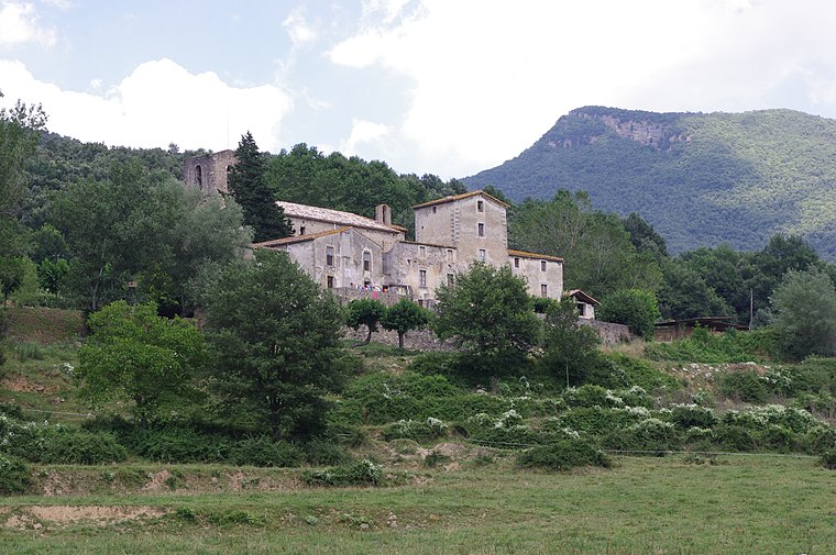
Photo: Àlex, CC BY-SA 3.0.
Granollers de Rocacorba is a hamlet, which is situated 3½ km south of Font de Perecollell.
Font de Perecollell
- Type: Spring
- Category: body of water
- Location: Sant Miquel de Campmajor, Girona, Catalonia, Eastern Spain, Spain, Iberia, Europe
- View on OpenStreetMap
Latitude
42.10154° or 42° 6′ 6″ northLongitude
2.65566° or 2° 39′ 20″ eastOpen location code
8FJ44M24+J7OpenStreetMap ID
node 5864826942OpenStreetMap feature
natural=spring
This page is based on OpenStreetMap, Wikidata, and Wikimedia Commons.
We’d love your help improving our open data sources. Thank you for contributing.
Satellite Map
Discover Font de Perecollell from above in high-definition satellite imagery.
Notable Places Nearby
Highlights include Font de l’Abocador and Fontanella.
Nearby Places
Explore places such as Volta a la Vall and Can Salavia.
Girona: Must-Visit Destinations
Delve into Girona, Figueres, Llivia, and Lloret de Mar.
Curious Springs to Discover
Uncover intriguing springs from every corner of the globe.
About Mapcarta. Data © OpenStreetMap contributors and available under the Open Database License". Text is available under the CC BY-SA 4.0 license, except for photos, directions, and the map. Photo: Wikimedia, CC0.