Harbor Life Then and Now
Harbor Life Then and Now is a work of art in Charlotte, Florida. Harbor Life Then and Now is situated nearby to the fire station City of Punta Gorda Fire Department, as well as near the public building Punta Gorda Public Safety Complex.| Tap on a place to explore it |
Places of Interest Nearby
Highlights include H. W. Smith Building and Charlotte Regional Medical Center.
H. W. Smith Building
Historic building

Photo: Wknight94, CC BY-SA 3.0.
The H. W. Smith Building is a historic site in Punta Gorda, Florida, United States. It is located at 121 East Marion Avenue and was added to the National Register of Historic Places in 1991. H. W. Smith Building is situated 1 mile north of Harbor Life Then and Now.
Charlotte Regional Medical Center
Hospital
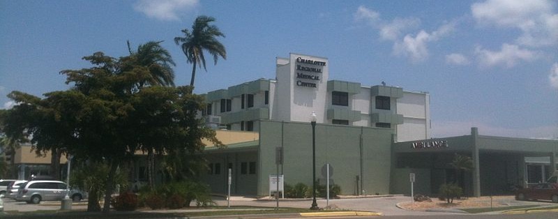
Photo: PCHS-NJROTC, CC BY-SA 3.0.
ShorePoint Health Punta Gorda, is a hospital in Punta Gorda, Florida, United States owned by AdventHealth. The hospital was purchased from Community Health Systems in March 2025. Charlotte Regional Medical Center is situated 1¼ miles north of Harbor Life Then and Now.
Places in the Area
Nearby places include Punta Gorda and Charlotte Park.
Punta Gorda

Photo: Isles Yacht Club, CC BY 2.0.
Punta Gorda is a city in Southwest Florida. After being devastated by a hurricane in 2004, the city has rebounded by building a new marina the Harborwalk, Linear Park and various trails throughout the city for bicycle and pedestrian traffic.
Charlotte Park
Village
Charlotte Park is a census-designated place in Charlotte County, Florida, United States. The population was 2,667 at the 2020 census, up from 2,325 at the 2010 census.
Solana
Hamlet
Solana is an unincorporated community and census-designated place in Charlotte County, Florida, United States. The population was 671 at the 2020 census, down from 742 at the 2010 census. Solana is situated 1½ miles northeast of Harbor Life Then and Now.
Harbor Life Then and Now
- Type: Work of art
- Artwork type: mural
- Category: tourism
- Location: Charlotte, Florida, United States, North America
- View on OpenStreetMap
Latitude
26.92359° or 26° 55′ 25″ northLongitude
-82.04775° or 82° 2′ 52″ westOpen location code
76RVWXF2+CWOpenStreetMap ID
node 5904871844OpenStreetMap feature
tourism=artworkOpenStreetMap attribute
artwork_type=mural
This page is based on OpenStreetMap, Wikidata, and Wikimedia Commons.
We’d love your help improving our open data sources. Thank you for contributing.
Satellite Map
Discover Harbor Life Then and Now from above in high-definition satellite imagery.
Notable Places Nearby
Highlights include City of Punta Gorda Fire Department and Punta Gorda Public Safety Complex.
Nearby Places
Explore places such as IHOP and Budget Inn-Punta Gorda.
Florida: Must-Visit Destinations
Delve into Miami, Orlando, Walt Disney World, and Tallahassee.
Curious Work Of Arts to Discover
Uncover intriguing work of arts from every corner of the globe.
About Mapcarta. Data © OpenStreetMap contributors and available under the Open Database License". Text is available under the CC BY-SA 4.0 license, except for photos, directions, and the map. Photo: Wikimedia, CC BY-SA 3.0.