Point de vue - Téléphérique du Mont-Faron
Point de vue - Téléphérique du Mont-Faron is a scenic viewpoint in Toulon, Var, Provence-Alpes-Côte d’Azur. Point de vue - Téléphérique du Mont-Faron is situated nearby to the museum Memorial of the landing in Provence, as well as near Climbing site ‘Téléphérique’.| Tap on a place to explore it |
Places of Interest Nearby
Highlights include Memorial of the landing in Provence and Mont Faron.
Memorial of the landing in Provence
Museum

Photo: Wikimedia, Public domain.
Memorial of the landing in Provence is a museum, which is situated 120 metres northwest of Point de vue - Téléphérique du Mont-Faron.
Mont Faron
Peak
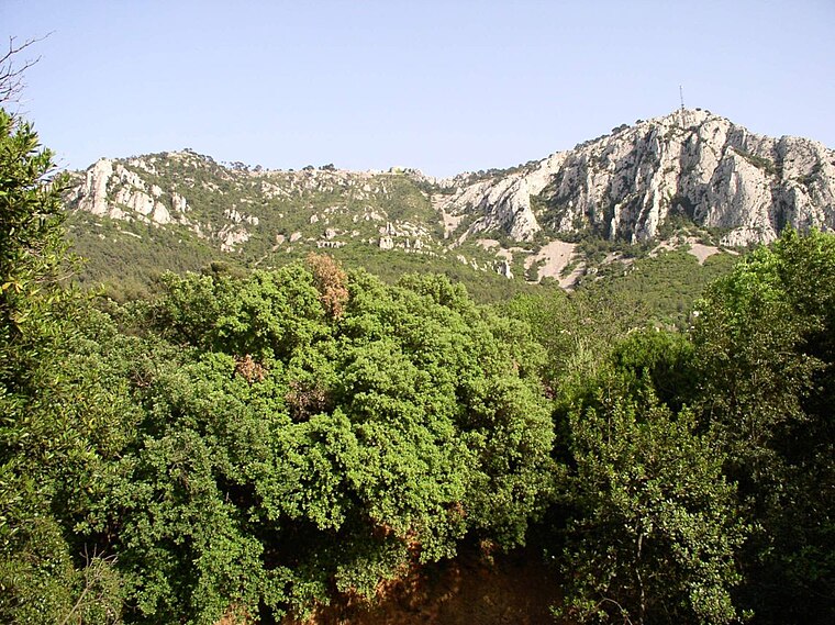
Photo: Wikimedia, CC BY-SA 1.0.
Mont Faron is a mountain overlooking the city and roadstead of Toulon, France. It is 584m high. At its peak is a memorial dedicated to the 1944 Allied landings in Provence, and to the liberation of Toulon.
Fort du Grand Saint-Antoine
Fort

Photo: Jose.gil, CC BY-SA 4.0.
Fort du Grand Saint-Antoine is situated 1¼ km southwest of Point de vue - Téléphérique du Mont-Faron.
Places in the Area
Nearby places include Basse Ville and Le Mourillon.
Basse Ville
Suburb

Photo: SiefkinDR, Public domain.
Basse Ville is a suburb, which is situated 3 km south of Point de vue - Téléphérique du Mont-Faron.
Le Mourillon
Suburb

Photo: Maisrimer, Public domain.
Le Mourillon is a neighbourhood to the east of the French city of Toulon, near the entrance to the Rade or roadstead. It was once a fishing village, and then became the home of many of the officers of the French fleet and to part of the naval dockyard. Le Mourillon is situated 4½ km south of Point de vue - Téléphérique du Mont-Faron.
La Valette-du-Var
Town

Photo: Esby, CC BY-SA 3.0.
La Valette-du-Var is a commune in the Var department in the Provence-Alpes-Côte d'Azur region in Southeastern France. La Valette-du-Var is situated 4½ km east of Point de vue - Téléphérique du Mont-Faron.
Point de vue - Téléphérique du Mont-Faron
- Type: Scenic viewpoint
- Category: tourism
- Location: Toulon, Arrondissement of Toulon, Var, Provence-Alpes-Côte d’Azur, France, Europe
- View on OpenStreetMap
Latitude
43.14926° or 43° 8′ 57″ northLongitude
5.93034° or 5° 55′ 49″ eastOpen location code
8FM74WXJ+P4OpenStreetMap ID
node 5979669091OpenStreetMap feature
tourism=viewpoint
This page is based on OpenStreetMap, Wikidata, and Wikimedia Commons.
We’d love your help improving our open data sources. Thank you for contributing.
Satellite Map
Discover Point de vue - Téléphérique du Mont-Faron from above in high-definition satellite imagery.
Notable Places Nearby
Highlights include Climbing site ‘Téléphérique’ and Voies d’escalade.
Nearby Places
Explore places such as Station Haute and Le Panoramique.
Var: Must-Visit Destinations
Delve into Saint-Tropez, Hyères, Fréjus, and Saint-Raphaël.
Curious Scenic Viewpoints to Discover
Uncover intriguing scenic viewpoints from every corner of the globe.
About Mapcarta. Data © OpenStreetMap contributors and available under the Open Database License". Text is available under the CC BY-SA 4.0 license, except for photos, directions, and the map. Photo: yves Tennevin, CC BY 2.0.