Radiologie Darmstadt
Radiologie Darmstadt is a doctor’s office in Darmstadt, Wissenschaftsstadt, Darmstadt, Hesse. Radiologie Darmstadt is situated nearby to the hill Fliederberg, as well as near Akazienpark.| Tap on a place to explore it |
Places of Interest Nearby
Highlights include Ingelheimer Garten and Orangerie.
Ingelheimer Garten
Park

Photo: Assenmacher, CC BY-SA 4.0.
Ingelheimer Garten is a park, which is situated 190 metres east of Radiologie Darmstadt.
Orangerie

Photo: Wikimedia, CC BY-SA 3.0.
The Orangerie in Darmstadt, Germany, built around 1720, is a baroque palace building designed by the architect Louis Remy de la Fosse. Originally, it served as a winter shelter for citrus plants sensitive to the cold, which adorned the surrounding parkland in the summer months. Orangerie is situated 1 km east of Radiologie Darmstadt.
Darmstadt Central Station
Railway station
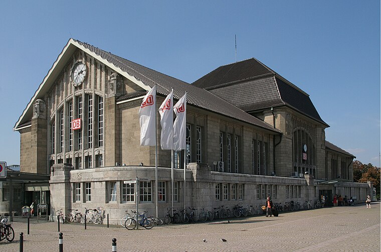
Photo: Mauritsvink, Public domain.
Darmstadt Hauptbahnhof is the main railway station in the German city Darmstadt. After Frankfurt Hbf and Wiesbaden Hbf, it is the third largest station in the state of Hesse with 35,000 passengers and 220 trains per day. Darmstadt Central Station is situated 1½ km northwest of Radiologie Darmstadt.
Places in the Area
Nearby places include Bessungen and Steubenplatz.
Bessungen
Quarter
Photo: Wikimedia, CC BY-SA 3.0.
Bessungen is a district in the South of the city of Darmstadt in Hesse.

St.-Barbara-Siedlung
Neighborhood

Photo: Jolly Lobster, CC BY-SA 4.0.
St.-Barbara-Siedlung is a neighborhood, which is situated 3 km south of Radiologie Darmstadt.
Radiologie Darmstadt
- Type: Doctor’s office
- Category: health care
- Location: Darmstadt, Wissenschaftsstadt, Darmstadt, South Hesse, Hesse, Germany, Central Europe, Europe
- View on OpenStreetMap
Latitude
49.86087° or 49° 51′ 39″ northLongitude
8.63844° or 8° 38′ 18″ eastOpen location code
8FXCVJ6Q+89OpenStreetMap ID
node 6032270573OpenStreetMap feature
amenity=doctorsOpenStreetMap feature
healthcare=doctor
This page is based on OpenStreetMap, Wikidata, and Wikimedia Commons.
We’d love your help improving our open data sources. Thank you for contributing.
Satellite Map
Discover Radiologie Darmstadt from above in high-definition satellite imagery.
Notable Places Nearby
Highlights include Fliederberg and Akazienpark.
Nearby Places
Explore places such as Hausarztpraxis Dr. Gül and Oishii Sushi & Grill.
South Hesse: Must-Visit Destinations
Delve into Bensheim, Lorsch, Heppenheim, and Dreieich.
Curious Doctor’s Offices to Discover
Uncover intriguing doctor’s offices from every corner of the globe.
About Mapcarta. Data © OpenStreetMap contributors and available under the Open Database License". Text is available under the CC BY-SA 4.0 license, except for photos, directions, and the map. Photo: Inkey, Public domain.