Gendarmerie nationale
Gendarmerie nationale is a police station in Richelieu, Arrondissement of Chinon, Centre-Val de Loire. Gendarmerie nationale is situated nearby to the social service facility Ehpad Marcel Fortier, as well as near the building Gare de Richelieu.| Tap on a place to explore it |
- Opening hours:
Monday: 8:00 AM—noon and 2:00 PM—6:00 PM
Wednesday: 8:00 AM—noon and 2:00 PM—6:00 PM
Friday—Saturday: 8:00 AM—noon and 2:00 PM—6:00 PM
public holidays: 9:00 AM—noon and 3:00 PM—6:00 PM - Type: Police station
- Also known as: “Brigade de gendarmerie de Richelieu”
Places of Interest Nearby
Highlights include Château de Richelieu and Église Notre-Dame de Richelieu.
Château de Richelieu
Park
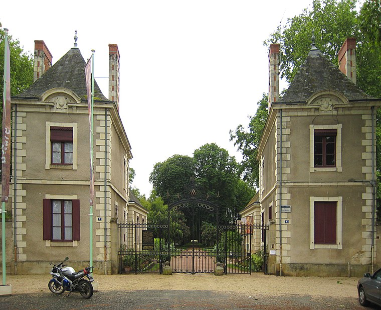
Photo: Manfred Heyde, CC BY-SA 3.0.
The Château de Richelieu was an enormous 17th-century château built by the French clergyman, nobleman, and statesman Cardinal Richelieu in Touraine. It was demolished for building materials in 1805 and almost nothing of it remains today. Château de Richelieu is situated 1 km southeast of Gendarmerie nationale.
Église Notre-Dame de Richelieu
Church

Photo: Picte, CC BY-SA 4.0.
Église Notre-Dame de Richelieu is a church, which is situated 720 metres east of Gendarmerie nationale.
Château de la Pataudière
Castle

Photo: Arcyon37, CC BY-SA 4.0.
Château de la Pataudière is a castle, which is situated 3 km north of Gendarmerie nationale.
Places in the Area
Nearby places include Ceaux-en-Loudun and Maulay.
Ceaux-en-Loudun
Village
Ceaux-en-Loudun is a commune in the Vienne department in the Nouvelle-Aquitaine region in western France. Ceaux-en-Loudun is situated 6 km west of Gendarmerie nationale.
Maulay
Village
Maulay is a commune in the Vienne department in the Nouvelle-Aquitaine region in western France. Maulay is situated 8 km southwest of Gendarmerie nationale.
Prinçay
Village

Photo: Wikimedia, CC BY-SA 3.0.
Prinçay is a commune in the Vienne department in the Nouvelle-Aquitaine region in western France. Prinçay is situated 10 km southwest of Gendarmerie nationale.
Gendarmerie nationale
Latitude
47.01129° or 47° 0′ 41″ northLongitude
0.3138° or 0° 18′ 50″ eastOperator
National GendarmerieOpen location code
8FV22867+GGOpenStreetMap ID
node 6068039275OpenStreetMap feature
amenity=police
This page is based on OpenStreetMap, Wikidata, and Wikimedia Commons.
We’d love your help improving our open data sources. Thank you for contributing.
Satellite Map
Discover Gendarmerie nationale from above in high-definition satellite imagery.
Places with the Same Name
Discover other places named “Gendarmerie nationale”.
Notable Places Nearby
Highlights include Ehpad Marcel Fortier and Gare de Richelieu.
Nearby Places
Explore places such as Espace Funéraire and Piscine municipale.
Centre-Val de Loire: Must-Visit Destinations
Delve into Orléans, Tours, Chartres, and Bourges.
Curious Police Stations to Discover
Uncover intriguing police stations from every corner of the globe.
About Mapcarta. Data © OpenStreetMap contributors and available under the Open Database License". Text is available under the CC BY-SA 4.0 license, except for photos, directions, and the map. Photo: Popolon, CC BY-SA 3.0.