Gendarmerie nationale
Gendarmerie nationale is a police station in La Flèche, Sarthe, Pays de la Loire. Gendarmerie nationale is situated nearby to the sports venue Gymnase du Petit Versailles, as well as near the swimming pool Piscine François-Monguillon.| Tap on a place to explore it |
- Opening hours:
Monday—Saturday: 8:00 AM—noon and 2:00 PM—6:00 PM
Sunday: 9:00 AM—noon and 3:00 PM—6:00 PM
public holidays: 9:00 AM—noon and 3:00 PM—6:00 PM - Type: Police station
- Also known as: “Brigade de gendarmerie de la Flèche”
Places of Interest Nearby
Highlights include Prytanée national militaire and Carmes Castle.
Prytanée national militaire
School
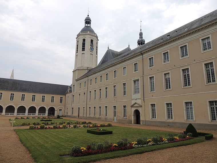
Photo: HubertduMaine, CC BY-SA 3.0.
The Prytanée national militaire is a French military school managed by the French military, offering regular secondary education as well as special preparatory classes, equivalent in level to the first years of university, for students who wish to enter French military academies. Prytanée national militaire is situated 790 metres south of Gendarmerie nationale.
Carmes Castle
Castle

Photo: Manfred Heyde, CC BY-SA 4.0.
Carmes Castle is a building located in La Flèche in the Sarthe department. Established as a fortress in the mid-11th century, it was transformed by the Carmelites in the 17th century, who set up their convent there, and then became a private dwelling after the Revolution. Carmes Castle is situated 1½ km south of Gendarmerie nationale.
Église Saint-Thomas de La Flèche
Church
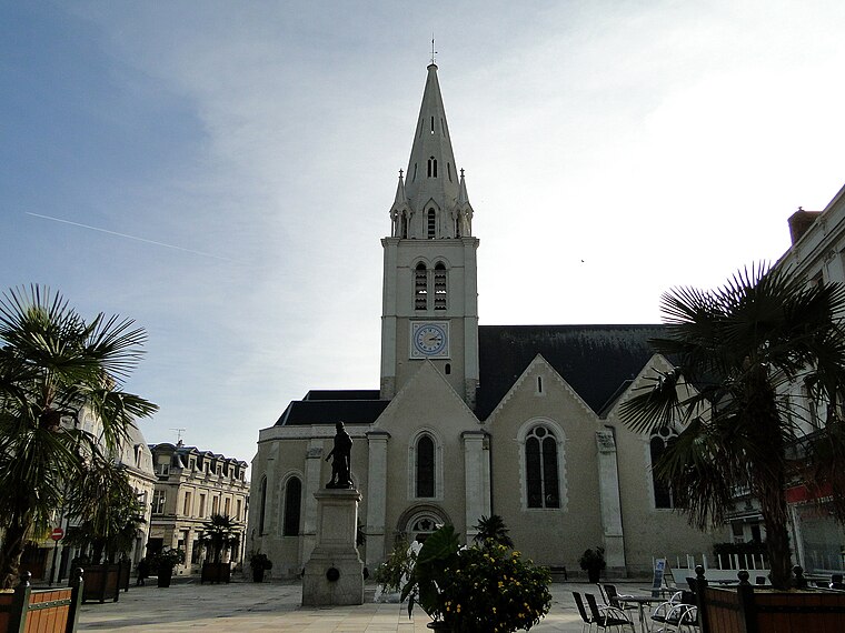
Photo: Skouame, CC BY-SA 3.0.
Église Saint-Thomas de La Flèche is a church, which is situated 1¼ km south of Gendarmerie nationale.
Places in the Area
Nearby places include La Flèche and Cré-sur-Loir.
La Flèche
Town

Photo: Skouame, CC BY-SA 3.0.
La Flèche is a town and commune in the French department of Sarthe, in the Pays de la Loire region in the Loire Valley. It is the sub-prefecture of the South-Sarthe, the chief district and the chief city of a canton, and the second most populous city of the department.
Cré-sur-Loir
Village
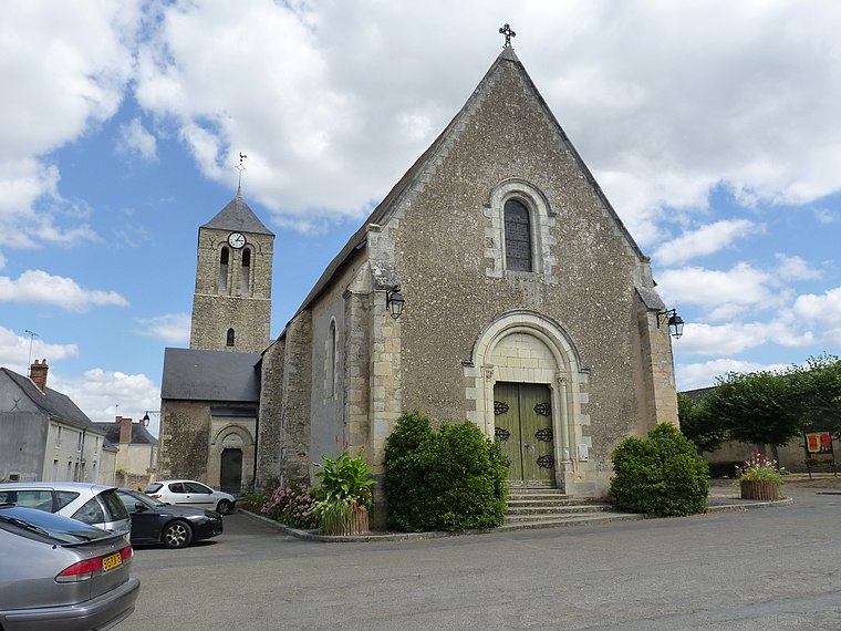
Photo: Wikimedia, CC BY-SA 3.0.
Cré-sur-Loir is a former commune in the Sarthe department in the Pays de la Loire region in north-western France. On 1 January 2017, it was merged into the new commune Bazouges Cré sur Loir. Its population was 758 in 2022. Cré-sur-Loir is situated 7 km southwest of Gendarmerie nationale.
Clefs
Village

Photo: Skouame, CC BY-SA 3.0.
Clefs is a former commune in the Maine-et-Loire department in western France. In January 2013 it merged with Vaulandry to form the commune of Clefs-Val d'Anjou, which merged into the commune Baugé-en-Anjou on 1 January 2016. Its population was 1,064 in 2022. Clefs is situated 10 km south of Gendarmerie nationale.
Gendarmerie nationale
Latitude
47.70963° or 47° 42′ 35″ northLongitude
-0.07765° or 0° 4′ 40″ westOperator
National GendarmerieOpen location code
8CVXPW5C+VWOpenStreetMap ID
node 6068433396OpenStreetMap feature
amenity=police
This page is based on OpenStreetMap, Wikidata, and Wikimedia Commons.
We’d love your help improving our open data sources. Thank you for contributing.
Satellite Map
Discover Gendarmerie nationale from above in high-definition satellite imagery.
Places with the Same Name
Discover other places named “Gendarmerie nationale”.
Notable Places Nearby
Highlights include Gymnase du Petit Versailles and Piscine François-Monguillon.
Nearby Places
Explore places such as IME Val de Loir and CER.
Pays de la Loire: Must-Visit Destinations
Delve into Montsoreau, Nantes, Angers, and Le Mans.
Curious Police Stations to Discover
Uncover intriguing police stations from every corner of the globe.
About Mapcarta. Data © OpenStreetMap contributors and available under the Open Database License". Text is available under the CC BY-SA 4.0 license, except for photos, directions, and the map. Photo: Crochet.david, CC BY-SA 3.0.