Ringerbrunnen
Ringerbrunnen is a work of art in Braunschweig, Brunswick, Lower Saxony. Ringerbrunnen is situated nearby to the art gallery Galerie Jaeschke, as well as near the retail building Spitzenhaus.| Tap on a place to explore it |
Places of Interest Nearby
Highlights include Brunswick Cathedral and Ringerbrunnen.
Brunswick Cathedral
Church
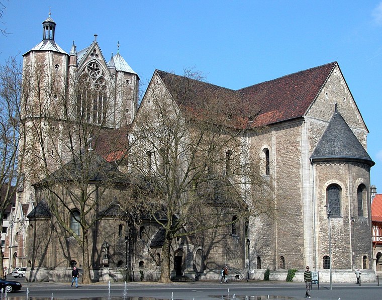
Photo: Brunswyk, Public domain.
Brunswick Cathedral is a large Lutheran church in the City of Braunschweig, Germany. The church is termed Dom, in German a synecdoche - pars pro toto - used for cathedrals and collegiate churches alike, and much like the Italian duomo. Brunswick Cathedral is situated 150 metres east of Ringerbrunnen.

Brunswick Lion

Photo: Brunswyk, CC BY-SA 3.0.
The Brunswick Lion is a medieval sculpture, created in bronze between 1164 and 1176, and the best-known landmark in the German city of Brunswick. The Brunswick Lion was originally located on the Burgplatz square in front of the Brunswick Cathedral. Brunswick Lion is situated 150 metres northeast of Ringerbrunnen.
Places in the Area
Nearby places include Magniviertel and Östliches Ringgebiet.

Östliches Ringgebiet
Suburb

Photo: Brunswyk, CC BY-SA 3.0 de.
The Östliches Ringgebiet is a Stadtbezirk in the eastern part of Braunschweig, Germany. With a population of 26,559 it is the city's second most populous district.
Mastbruch-Elmaussicht
Quarter

Photo: TeWeBs, CC BY-SA 3.0.
Mastbruch-Elmaussicht is a quarter, which is situated 4 km east of Ringerbrunnen.
Ringerbrunnen
- Type: Work of art
- Artwork_type: sculpture
- Category: tourism
- Location: Braunschweig, Brunswick, Brunswick Land, Lower Saxony, Germany, Central Europe, Europe
- View on OpenStreetMap
Latitude
52.26407° or 52° 15′ 51″ northLongitude
10.52183° or 10° 31′ 19″ eastOpen location code
9F4G7G7C+JPOpenStreetMap ID
node 60753209OpenStreetMap feature
tourism=artworkOpenStreetMap attribute
artwork_type=sculpture
This page is based on OpenStreetMap, Wikidata, and Wikimedia Commons.
We’d love your help improving our open data sources. Thank you for contributing.
Satellite Map
Discover Ringerbrunnen from above in high-definition satellite imagery.
Places with the Same Name
Discover other places named “Ringerbrunnen”.
Notable Places Nearby
Highlights include Galerie Jaeschke and Spitzenhaus.
Nearby Places
Explore places such as Contigo Fairtrade and HaarPflegeShop.
Brunswick Land: Must-Visit Destinations
Delve into Wolfsburg, Salzgitter, Wolfenbüttel, and Helmstedt.
Curious Work Of Arts to Discover
Uncover intriguing work of arts from every corner of the globe.
About Mapcarta. Data © OpenStreetMap contributors and available under the Open Database License". Text is available under the CC BY-SA 4.0 license, except for photos, directions, and the map. Photo: Captaingrog, CC BY-SA 2.5.