Boule lyonnaise Lucien Ferron
Boule lyonnaise Lucien Ferron is a pitch in Montpellier, Hérault, Occitanie. Boule lyonnaise Lucien Ferron is situated nearby to the park Union des Pins, as well as near the sports venue Piscine Jean Vives.| Tap on a place to explore it |
Places of Interest Nearby
Highlights include Saint Michael de Montels church and Montpellier St. Roch Railway Station.
Saint Michael de Montels church
Church

Photo: Sapin88, CC BY-SA 4.0.
Saint Michael de Montels church is situated 580 metres southwest of Boule lyonnaise Lucien Ferron.
Montpellier St. Roch Railway Station
Railway station

Photo: Parisdreux, CC BY-SA 3.0.
Montpellier-Saint-Roch station is the main railway station in Montpellier, France. The station was formerly known as Gare de Montpellier, but since March 2005 it has been named after Saint Roch, a native of the city who was born in the 14th century. Montpellier St. Roch Railway Station is situated 2 km north of Boule lyonnaise Lucien Ferron.
Église Saint Jacques
Church
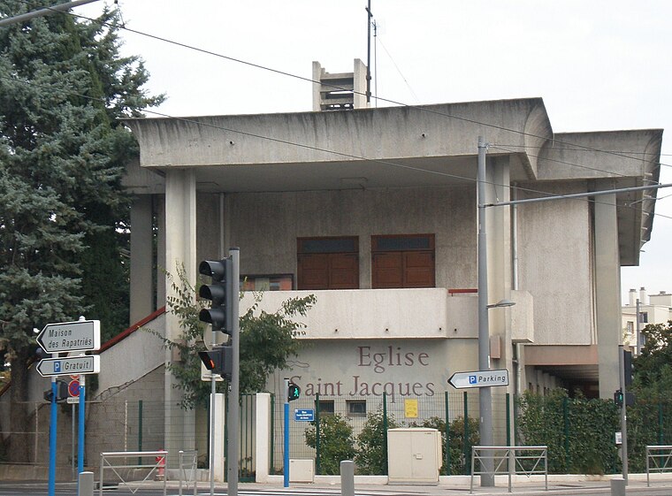
Photo: Vpe, Public domain.
Église Saint Jacques is a church, which is situated 720 metres north of Boule lyonnaise Lucien Ferron.
Places in the Area
Nearby places include Antigone and Lattes.
Antigone
Neighborhood
 Antigone is a neighbourhood of Montpellier, France, east of the city centre. It is best known for its architectural design by Ricardo Bofill Taller de Arquitectura. Antigone is situated 2½ km northeast of Boule lyonnaise Lucien Ferron.
Lattes
Town

Photo: Alexander Baranov, CC BY 2.0.
Lattes is a commune in the Hérault département in the Occitanie region in southern France, located just on the outskirts of Montpellier. Lattes is situated 3½ km southeast of Boule lyonnaise Lucien Ferron.
Saint Jean de Védas
Town

Photo: Fagairolles 34, CC BY-SA 4.0.
Saint-Jean-de-Védas is a commune in the Hérault department in the Occitanie region in southern France. Saint Jean de Védas is situated 4 km west of Boule lyonnaise Lucien Ferron.
Boule lyonnaise Lucien Ferron
- Type: Pitch
- Categories: recreation area, bocce, and sports location
- Location: Montpellier, Arrondissement of Montpellier, Hérault, Occitanie, France, Europe
- View on OpenStreetMap
Latitude
43.58896° or 43° 35′ 20″ northLongitude
3.87311° or 3° 52′ 23″ eastOpen location code
8FM5HVQF+H6OpenStreetMap ID
node 608187578OpenStreetMap feature
leisure=pitchOpenStreetMap feature
sport=boules
This page is based on OpenStreetMap, Wikidata, and Wikimedia Commons.
We’d love your help improving our open data sources. Thank you for contributing.
Satellite Map
Discover Boule lyonnaise Lucien Ferron from above in high-definition satellite imagery.
Notable Places Nearby
Highlights include Union des Pins and Piscine Jean Vivès.
Nearby Places
Explore places such as CD and Passerines.
Hérault: Must-Visit Destinations
Delve into Béziers, Sète, Bouzigues, and Pézenas.
Curious Pitches to Discover
Uncover intriguing pitches from every corner of the globe.
About Mapcarta. Data © OpenStreetMap contributors and available under the Open Database License". Text is available under the CC BY-SA 4.0 license, except for photos, directions, and the map. Photo: Wolfgang Staudt, CC BY 2.0.