Parkplatz Fäulesloch
Parkplatz Fäulesloch is in Bingen, Sigmaringen, Baden-Württemberg. Parkplatz Fäulesloch is situated nearby to the castle Ruine Hornstein, as well as near the cave Bittelschießer Höhle.| Tap on a place to explore it |
Places of Interest Nearby
Highlights include Ruine Bittelschieß and Hanfertal station.
Ruine Bittelschieß
Castle

Photo: Louis Bafrance, CC BY-SA 3.0.
Ruine Bittelschieß is a castle, which is situated 620 metres southwest of Parkplatz Fäulesloch.
Hanfertal station
Railway station

Photo: Hohenzollernsche Lande, CC BY-SA 4.0.
Hanfertal station is a railway station, which is situated 2½ km southwest of Parkplatz Fäulesloch.
Ruine Hertenstein
Castle

Photo: Wikimedia, CC BY-SA 3.0.
Ruine Hertenstein is a castle, which is situated 3½ km west of Parkplatz Fäulesloch.
Places in the Area
Nearby places include Sigmaringen and Sigmaringendorf.
Sigmaringen

Photo: Berthold Werner, CC BY-SA 4.0.
Sigmaringen is a town in southern Germany, in the state of Baden-Württemberg. Situated on the upper Danube, it is the capital of the Sigmaringen district.
Sigmaringendorf
Village
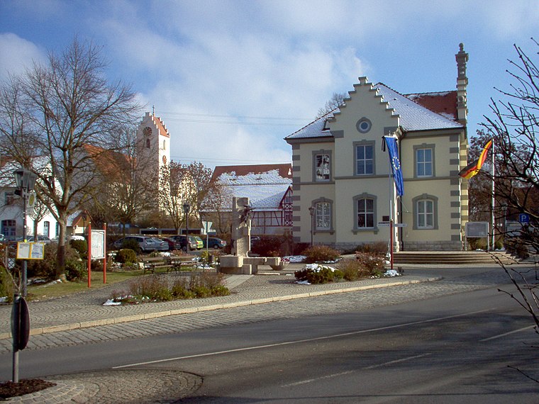
Photo: Louis Bafrance, CC BY-SA 3.0.
Sigmaringendorf is a small town in the district of Sigmaringen in Baden-Württemberg in Germany. In Sigmaringendorf the small river Lauchert flows into the Danube. There is an open-air-theatre in Sigmaringendorf, it's called Waldbühne Sigmaringendorf. Sigmaringendorf is situated 5 km south of Parkplatz Fäulesloch.
Scheer
Village
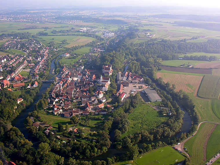
Photo: Simisa, CC BY-SA 3.0.
Scheer is a town in the district of Sigmaringen, in Baden-Württemberg, Germany. It is situated on the Danube, 6 km east of Sigmaringen. Scheer is situated 5 km southeast of Parkplatz Fäulesloch.
Parkplatz Fäulesloch
- Type: Sign
- Categories: information and tourism
- Location: Bingen, Sigmaringen, Tübingen Region, Baden-Württemberg, Germany, Central Europe, Europe
- View on OpenStreetMap
Latitude
48.11008° or 48° 6′ 36″ northLongitude
9.26267° or 9° 15′ 46″ eastElevation
603 metres (1,978 feet)Open location code
8FWF4767+23OpenStreetMap ID
node 6089499184OpenStreetMap feature
tourism=information
This page is based on OpenStreetMap, Wikidata, and Wikimedia Commons.
We’d love your help improving our open data sources. Thank you for contributing.
Satellite Map
Discover Parkplatz Fäulesloch from above in high-definition satellite imagery.
Notable Places Nearby
Highlights include Fäules Loch and Ruine Hornstein.
Nearby Places
Explore places such as Steg in der Au and Hornstein Wendeplatte.
Baden-Württemberg: Must-Visit Destinations
Delve into Stuttgart, Heidelberg, Karlsruhe, and Mannheim.
Curious Places to Discover
Uncover intriguing places from every corner of the globe.
About Mapcarta. Data © OpenStreetMap contributors and available under the Open Database License". Text is available under the CC BY-SA 4.0 license, except for photos, directions, and the map. Photo: Traveler100, CC BY-SA 3.0.