TT65
The Theban Tomb TT65 is located in Sheikh Abd el-Qurna. It forms part of the Theban Necropolis, situated on the west bank of the Nile opposite to Luxor.| Tap on a place to explore it |
Photo: Kingtut, CC BY-SA 3.0.
- Type: Tomb
- Description: Theban Tomb TT65 is located in Sheikh Abd el-Qurna. It forms part of the Theban Necropolis, situated on the west bank of the Nile opposite to Luxor.
- Also known as: “TT65 Nebamun/Imiseba/Monastery of Cyriacus”
Places of Interest Nearby
Highlights include Valley of the Kings and Deir el-Bahri.
Valley of the Kings
 The Valley of the Kings is an Egyptian archaeological locality in the hills immediately behind the West Bank of Luxor. As such, it is one of the most remarkable archaeological destinations in the world - the burial place of most of the pharaohs of Egypt of the New Kingdom.
Deir el-Bahri
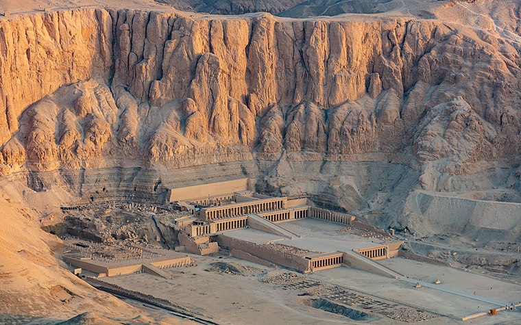
Photo: Wikimedia, CC BY-SA 4.0.
Deir el-Bahari or Dayr al-Bahri is a complex of mortuary temples and tombs located on the west bank of the Nile, opposite the city of Luxor, Egypt. This is a part of the Theban Necropolis. Deir el-Bahri is situated 510 metres north of TT65.
Theban Tomb 69 (Menna)

Photo: Ovedc, CC BY-SA 4.0.
Theban Tomb 69 is located in Sheikh Abd el-Qurna, part of the Theban Necropolis, on the west bank of the Nile, opposite Luxor. It is the burial place of the ancient Egyptian official named Menna, whose titles included ‘Overseer of Fields of Amun’, and ‘Overseer of Fields of the Lord of the Two Lands’.
Places in the Area
Nearby places include El-Assasif and Luxor.
El-Assasif
Village
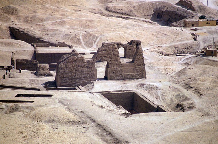
Photo: RolandUnger, CC BY-SA 3.0.
El-Assasif is a necropolis near Luxor on the West Bank at Thebes, Egypt, Upper Egypt. It is located in the dry bay that leads up to Deir el-Bahari and south of the necropolis of Dra' Abu el-Naga'.
Luxor

Photo: Blalonde, Public domain.
Luxor is a city in Upper Egypt. Luxor had a population of 284,952 in 2023, with an area of 43.0 km2 and is the capital of the Luxor Governorate. It is among the oldest continuously inhabited cities in the world.
East Bank

Photo: Belmahdy, CC BY-SA 4.0.
The East Bank of Luxor is the central part of Luxor township, centred on the twin foci of the Temple of Luxor and the Temple of Karnak.
TT65
- Categories: historic site and burial
- Location: New Valley Governorate, Egypt, North Africa, Africa
- View on OpenStreetMap
Latitude
25.73294° or 25° 43′ 59″ northLongitude
32.60889° or 32° 36′ 32″ eastOpen location code
7GQJPJM5+5HOpenStreetMap ID
node 6106997715OpenStreetMap feature
historic=tombWikidata ID
Q16511602
This page is based on OpenStreetMap, Wikidata, Wikimedia Commons, and Wikipedia.
We’d love your help improving our open data sources. Thank you for contributing.
Satellite Map
Discover TT65 from above in high-definition satellite imagery.
In Other Languages
From French to Italian—“TT65” goes by many names.
- French: “TT65”
- Hungarian: “TT65”
- Italian: “TT65”
Notable Places Nearby
Highlights include TT71 and Sheik abdel Qurna.
Nearby Places
Explore places such as Mond House and TT41 Amenemipet.
Egypt: Must-Visit Destinations
Delve into Cairo, Alexandria, Luxor, and Giza.
Curious Tombs to Discover
Uncover intriguing tombs from every corner of the globe.
About Mapcarta. Data © OpenStreetMap contributors and available under the Open Database License". Text is available under the CC BY-SA 4.0 license, except for photos, directions, and the map. Description text is based on the Wikipedia page “TT65”. Photo: Kingtut, CC BY-SA 3.0.