Ar-Rahman Moschee
Ar-Rahman Moschee is a mosque in Cologne, Cologne Lowland, North Rhine-Westphalia which is located on Eythstraße. Ar-Rahman Moschee is situated nearby to the hospital Evangelische Krankenhaus Kalk, as well as near the church Hll. Drei Könige.| Tap on a place to explore it |
Places of Interest Nearby
Highlights include Kalk chapel and Lanxess Arena.
Kalk chapel
Church

Photo: Elya, CC BY-SA 4.0.
Kalk chapel is a church, which is situated 350 metres south of Ar-Rahman Moschee.
Lanxess Arena
Stadium
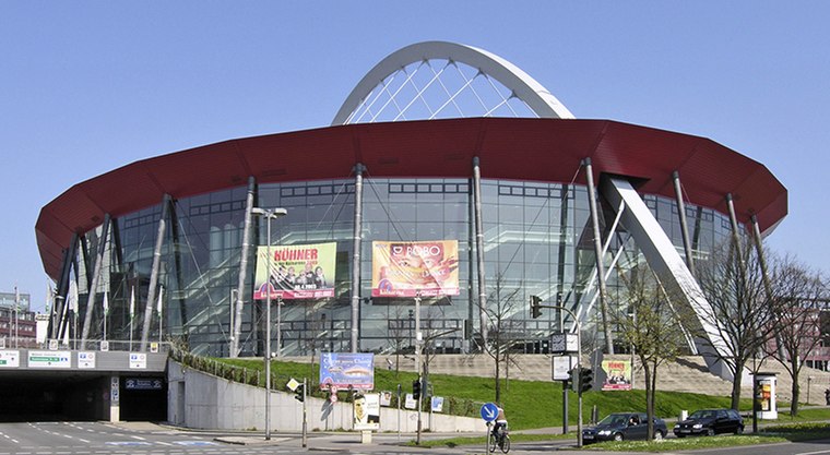
Photo: Hps-poll, CC BY-SA 3.0.
Lanxess Arena is an indoor arena, in Cologne, North Rhine-Westphalia, Germany. It is known as the 18,500-capacity home of the Kölner Haie and as one of Germany's major music venues. Lanxess Arena is situated 2 km west of Ar-Rahman Moschee.
St. Joseph
Place of worship

Photo: Wikimedia, CC BY-SA 3.0.
St. Joseph is a place of worship, which is situated 480 metres west of Ar-Rahman Moschee.
Places in the Area
Nearby places include Vingst and Deutz.

Deutz
Suburb

Photo: Tohma, CC BY-SA 4.0.
The Cologne borough of Deutz is a part of central Cologne, Germany, and was once an independent town known as Deutz am Rhein. Deutz is situated 2½ km west of Ar-Rahman Moschee.
Fort XI
Locality

Photo: Nicola, CC BY-SA 3.0.
Fort XI is a locality, which is situated 3½ km north of Ar-Rahman Moschee.
Ar-Rahman Moschee
- Type: Mosque
- Address: Eythstraße 44a, Köln, 51103
- Categories: place of worship and religion
- Location: Cologne, Cologne District, Cologne Lowland, North Rhine-Westphalia, Germany, Central Europe, Europe
- View on OpenStreetMap
Latitude
50.9418° or 50° 56′ 31″ northLongitude
7.01064° or 7° 0′ 38″ eastOperator
A.C.T.A. e.V.Open location code
9F29W2R6+P7OpenStreetMap ID
node 6110236495OpenStreetMap feature
amenity=place_of_worship
This page is based on OpenStreetMap, Wikidata, and Wikimedia Commons.
We’d love your help improving our open data sources. Thank you for contributing.
Satellite Map
Discover Ar-Rahman Moschee from above in high-definition satellite imagery.
Places with the Same Name
Discover other places named “Ar-Rahman Moschee”.
Notable Places Nearby
Highlights include Evangelische Krankenhaus Kalk and Hll. Drei Könige.
Nearby Places
Explore places such as Ebi’s Haustechnik and Hazara Backspezialitäten.
Cologne Lowland: Must-Visit Destinations
Delve into Bonn, Leverkusen, Siegburg, and Bad Honnef.
Curious Mosques to Discover
Uncover intriguing mosques from every corner of the globe.
About Mapcarta. Data © OpenStreetMap contributors and available under the Open Database License". Text is available under the CC BY-SA 4.0 license, except for photos, directions, and the map. Photo: Ahgee, CC BY-SA 3.0.