Au Argenwald
Au Argenwald is a bus stop in Damüls, Bregenz District, Vorarlberg. Au Argenwald is situated nearby to the mountain saddle Gumpener Höhe, as well as near the peak Gumpengrätle.| Tap on a place to explore it |
Places of Interest Nearby
Highlights include Zafernhorn and Damülser Mittagsspitze.
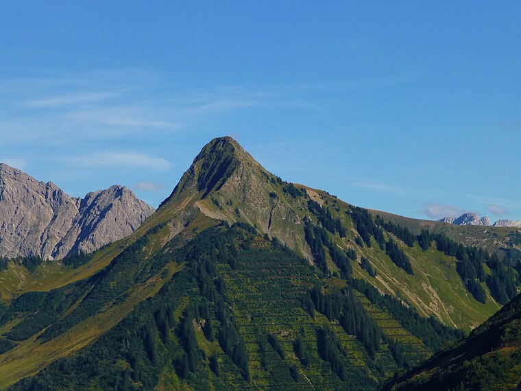
Damülser Mittagsspitze
Peak

Photo: Böhringer, CC BY-SA 2.5.
Damülser Mittagsspitze is a 2,095 m high mountain in the Bregenz Forest Mountains in the Austrian state Vorarlberg. The normal route starts from the upper station of a chairlift at 1810 m and is UIAA grade I. Damülser Mittagsspitze is situated 4 km northwest of Au Argenwald.
FIS Skimuseum Damüls
Museum

Photo: Asurnipal, CC BY-SA 4.0.
The FIS Skimuseum Damüls is a skiing museum located in Damüls in Vorarlberg. It is accommodated in the Kulisse Pfarrhof and displays exhibitions about local history and winter sports. FIS Skimuseum Damüls is situated 3 km southwest of Au Argenwald.
Places in the Area
Nearby places include Damüls and Annalpe.
Damüls
Village

Photo: Böhringer, CC BY-SA 2.5.
Damüls is a village community and popular tourist resort in the district of Bregenz in the westernmost Austrian state of Vorarlberg. Damüls is known for its abundance of snow. In 2006, Damüls was awarded the honorary title "the snowiest village in the world". Damüls is situated 3 km southwest of Au Argenwald.
Annalpe
Locality

Photo: Wikimedia, CC BY-SA 4.0.
Annalpe is a locality, which is situated 3½ km east of Au Argenwald.
Au
Village

Photo: Wikimedia, CC BY-SA 2.5.
Au is a town in the Bregenz Forest in Vorarlberg. Au is situated 5 km northeast of Au Argenwald.
Au Argenwald
- Type: Bus stop
- Category: transportation
- Location: Damüls, Bregenz District, Vorarlberg, Austria, Central Europe, Europe
- View on OpenStreetMap
Latitude
47.29158° or 47° 17′ 30″ northLongitude
9.92808° or 9° 55′ 41″ eastOpen location code
8FVF7WRH+J6OpenStreetMap ID
node 611598487OpenStreetMap feature
highway=bus_stopOpenStreetMap feature
public_transport=platform
This page is based on OpenStreetMap, Wikidata, and Wikimedia Commons.
We’d love your help improving our open data sources. Thank you for contributing.
Satellite Map
Discover Au Argenwald from above in high-definition satellite imagery.
Notable Places Nearby
Highlights include Gumpener Höhe and Gumpengrätle.
Nearby Places
Explore places such as Au Argenwald and Argenwaldalpe.
Vorarlberg: Must-Visit Destinations
Delve into Bregenz, Dornbirn, Feldkirch, and Bludenz.
Curious Bus Stops to Discover
Uncover intriguing bus stops from every corner of the globe.
About Mapcarta. Data © OpenStreetMap contributors and available under the Open Database License". Text is available under the CC BY-SA 4.0 license, except for photos, directions, and the map. Photo: Böhringer, CC BY-SA 2.5.