Südend
Südend is a neighborhood in Eberswalde, Barnim, Brandenburg. Südend is situated nearby to the neighborhood Hausberg, as well as near the suburb Ostend.| Tap on a place to explore it |
Places of Interest
Highlights include Heldenhain-Denkmal and Paul-Wunderlich-Haus.


Maria-Magdalenen-Kirche (Eberswalde)
Church

Photo: Ralf Roletschek, GFDL.
Maria-Magdalenen-Kirche (Eberswalde) is a church.
Places in the Area
Nearby places include Tornow and Hohenfinow.
Tornow
Village
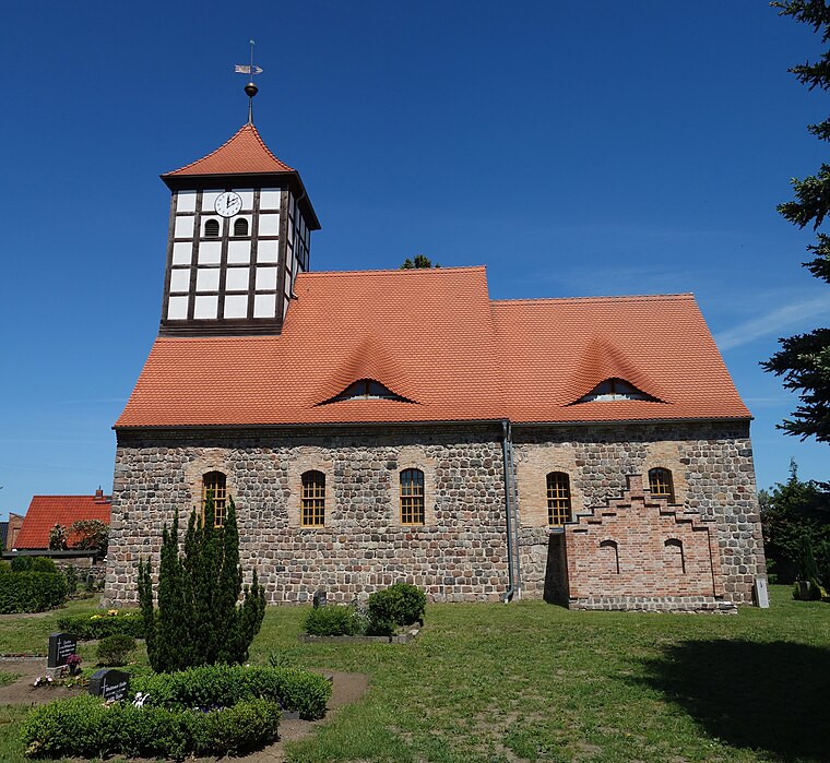
Photo: Hans G. Oberlack, CC BY-SA 4.0.
Tornow is a village, which is situated 4 km east of Südend.
Hohenfinow
Village

Photo: Hans G. Oberlack, CC BY-SA 4.0.
Hohenfinow is a municipality in the Barnim district in Brandenburg, Germany. It is part of the Amt Amt Britz-Chorin-Oderberg. Hohenfinow is situated 7 km east of Südend.
Niederfinow
Village

Photo: Ralf Roletschek, GFDL.
Niederfinow is a municipality in the district of Barnim in Brandenburg in Germany. Niederfinow is situated 7 km east of Südend.
Südend
- Type: Neighborhood
- Category: locality
- Location: Eberswalde, Barnim, Brandenburg, Germany, Central Europe, Europe
- View on OpenStreetMap
Latitude
52.82114° or 52° 49′ 16″ northLongitude
13.82826° or 13° 49′ 42″ eastOpen location code
9F4MRRCH+F8OpenStreetMap ID
node 6118580036OpenStreetMap feature
place=neighbourhood
This page is based on OpenStreetMap, Wikidata, and Wikimedia Commons.
We’d love your help improving our open data sources. Thank you for contributing.
Satellite Map
Discover Südend from above in high-definition satellite imagery.
Places with the Same Name
Discover other places named “Südend”.
Localities in the Area
Explore places such as Hausberg and Ostend.
Notable Places Nearby
Highlights include Arbeitsgericht Eberswalde (Haus 9) and Landesbetrieb Straßenwesen (Haus 8).
Brandenburg: Must-Visit Destinations
Delve into Potsdam, Cottbus, Frankfurt an der Oder, and Brandenburg an der Havel.
Curious Neighborhoods to Discover
Uncover intriguing neighborhoods from every corner of the globe.
About Mapcarta. Data © OpenStreetMap contributors and available under the Open Database License". Text is available under the CC BY-SA 4.0 license, except for photos, directions, and the map. Photo: Leviathan1983, CC BY-SA 3.0.