Ruusulehdon Koulu
Ruusulehdon Koulu is a school in Jakobstad, Ostrobothnia which is located on Pirilövägen. Ruusulehdon Koulu is situated nearby to the garden Aspegrens trädgård, as well as near the islet Nylundsgrundet.| Tap on a place to explore it |
Places of Interest Nearby
Highlights include Jakobstad City Hall and Pietarsaaren Saalem-seurakunta.
Jakobstad City Hall
Town hall
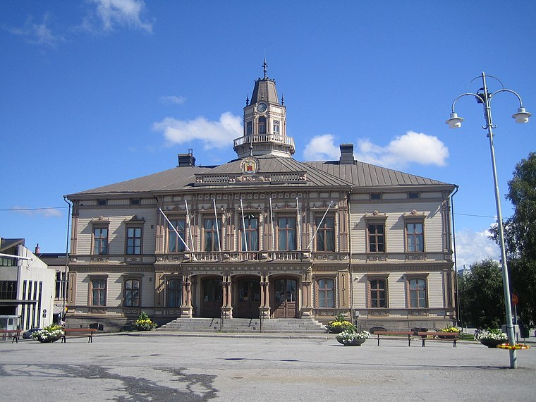
Photo: Tomisti, CC BY-SA 3.0.
Jakobstad City Hall is a historic building in the city of Jakobstad, Finland. It was completed in 1875. The current look of the building dates from 1890. Jakobstad City Hall is situated 2 km west of Ruusulehdon Koulu.
Pietarsaaren Saalem-seurakunta
Church

Photo: Weisself, CC BY-SA 4.0.
Pietarsaaren Saalem-seurakunta is a church, which is situated 2 km northwest of Ruusulehdon Koulu.
Kristallen
Sports venue

Photo: Pyhajumbo, CC BY-SA 2.5.
Kristallen is a sports venue, which is situated 2 km west of Ruusulehdon Koulu.
Places in the Area
Nearby places include Bennäs and Larsmo.
Bennäs
Town

Photo: Tomisti, CC BY-SA 3.0.
Bennäs is a village, urban area and railway station in the municipality of Pedersöre, Finland. It is the administrative center of the municipality, but the biggest urban area is Kållby. Bennäs is situated 8 km south of Ruusulehdon Koulu.
Larsmo

Photo: Zunter, CC BY-SA 4.0.
Larsmo is a municipality in Finland, located on the west coast of the country. Larsmo is situated in Ostrobothnia, along the Gulf of Bothnia. The population of Larsmo is approximately 6,000, while the sub-region has a population of approximately 51,000.
Ruusulehdon Koulu
- Type: School
- Address: Pirilövägen, Jakobstad, 68600
- Category: education
- Location: Jakobstad, Jakobstadsregionen, Ostrobothnia, West Coast, Finland, Nordic countries, Europe
- View on OpenStreetMap
Latitude
63.66843° or 63° 40′ 6″ northLongitude
22.74215° or 22° 44′ 32″ eastOpen location code
9GM4MP9R+9VOpenStreetMap ID
node 613328930OpenStreetMap feature
amenity=school
This page is based on OpenStreetMap, Wikidata, and Wikimedia Commons.
We’d love your help improving our open data sources. Thank you for contributing.
Satellite Map
Discover Ruusulehdon Koulu from above in high-definition satellite imagery.
Notable Places Nearby
Highlights include Aspegrens trädgård and Nylundsgrundet.
Nearby Places
Explore places such as Lövblomsfladan and Grannabba flada.
Ostrobothnia: Must-Visit Destinations
Delve into Vaasa, Kristinestad, Kaskinen, and Närpes.
Curious Places to Discover
Uncover intriguing places from every corner of the globe.
About Mapcarta. Data © OpenStreetMap contributors and available under the Open Database License". Text is available under the CC BY-SA 4.0 license, except for photos, directions, and the map. Photo: Wikimedia, CC0.