Pflegezentrum BrentanoStift
Pflegezentrum BrentanoStift is a social service facility in Aschaffenburg, Lower Franconia, Bavaria which is located on Lamprechtstraße. Pflegezentrum BrentanoStift is situated nearby to the church Spitalkirche St. Katharina, as well as near the health club FEEL IT NOW.| Tap on a place to explore it |
- Type: Social service facility
- Address: Lamprechtstraße 2
- Wheelchair access: yes
Places of Interest Nearby
Highlights include Spitalkirche St. Katharina and Collegiate Church of St Peter and St Alexander.
Spitalkirche St. Katharina
Church

Photo: Ekpah, CC BY-SA 3.0.
Spitalkirche St. Katharina is a church.
Collegiate Church of St Peter and St Alexander
Church
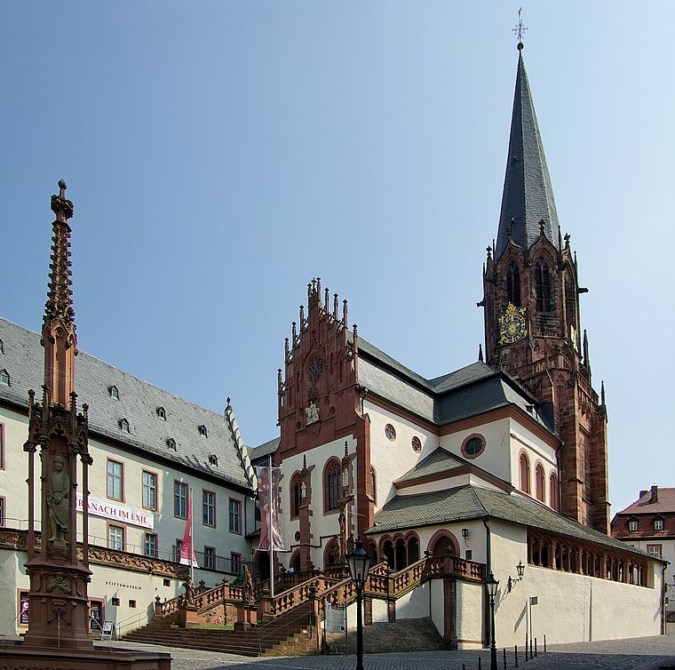
Photo: Wikimedia, CC BY-SA 3.0.
The church St. Peter und Alexander is a Catholic church located in Aschaffenburg, Bavaria, Germany. It is the town's oldest church, established in the 10th century, dedicated to Saint Peter and Saint Alexander. Collegiate Church of St Peter and St Alexander is situated 300 metres northwest of Pflegezentrum BrentanoStift.
Schönborner Hof

Photo: Peng, CC BY-SA 3.0.
Schönborner Hof is situated 240 metres northwest of Pflegezentrum BrentanoStift.
Places in the Area
Nearby places include Damm and Obernau.

Obernau
Village

Photo: Dysmachus, CC BY-SA 3.0.
Obernau is a village, which is situated 4 km south of Pflegezentrum BrentanoStift.
Mainaschaff
Village

Photo: Freak-Line-Community, CC BY-SA 3.0.
Mainaschaff is a community in the Aschaffenburg district in the Regierungsbezirk of Lower Franconia in Bavaria, Germany. It has a population of around 9,000. Mainaschaff is situated 4½ km west of Pflegezentrum BrentanoStift.
Pflegezentrum BrentanoStift
Latitude
49.97206° or 49° 58′ 19″ northLongitude
9.14985° or 9° 8′ 60″ eastOpen location code
8FXFX4CX+RWOpenStreetMap ID
node 6134758355OpenStreetMap feature
amenity=social_facilityOpenStreetMap attribute
wheelchair=yes
This page is based on OpenStreetMap, Wikidata, and Wikimedia Commons.
We’d love your help improving our open data sources. Thank you for contributing.
Satellite Map
Discover Pflegezentrum BrentanoStift from above in high-definition satellite imagery.
Notable Places Nearby
Highlights include FEEL IT NOW and Sportfeld Brentano-Schule.
Nearby Places
Explore places such as Postbank and Kieferorthopädie Somaya Afshar.
Lower Franconia: Must-Visit Destinations
Delve into Würzburg, Schweinfurt, Bad Kissingen, and Miltenberg.
Curious Social Service Facilities to Discover
Uncover intriguing social service facilities from every corner of the globe.
About Mapcarta. Data © OpenStreetMap contributors and available under the Open Database License". Text is available under the CC BY-SA 4.0 license, except for photos, directions, and the map. Photo: Rainer Lippert, CC0.