Hofladen Georg Straub
Hofladen Georg Straub is a convenience store in Bad Boll, Göppingen, Baden-Württemberg which is located on Badstraße. Hofladen Georg Straub is situated nearby to the church Heilig Kreuz, as well as near the cemetery Friedhof Bad Boll.| Tap on a place to explore it |
- Opening hours:
Monday—Thursday: 9:00 AM—noon
Friday: 9:00 AM—noon and 3:00 PM—6:00 PM
Saturday—Sunday: 9:00 AM—noon - Type: Convenience store
- Address: Badstraße 32, Bad Boll, 73087
Places of Interest Nearby
Highlights include Stiftskirche St. Cyriakus and Blumhardt-Friedhof.
Stiftskirche St. Cyriakus
Church
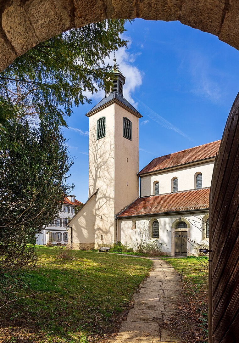
Photo: Aristeas, CC BY-SA 4.0.
Stiftskirche St. Cyriakus is a church, which is situated 400 metres east of Hofladen Georg Straub.
Blumhardt-Friedhof
Cemetery

Photo: Aristeas, CC BY-SA 4.0.
Blumhardt-Friedhof is a cemetery, which is situated 1 km northwest of Hofladen Georg Straub.
Schloss Dürnau
Castle

Photo: Xocolatl, Public domain.
Schloss Dürnau is a castle, which is situated 1½ km east of Hofladen Georg Straub.
Places in the Area
Nearby places include Pliensbach and Zell unter Aichelberg.
Pliensbach
Hamlet
Pliensbach is a hamlet in the municipality of Zell unter Aichelberg in the district of Göppingen in central Baden-Württemberg. Pliensbach is situated 2½ km northwest of Hofladen Georg Straub.
Zell unter Aichelberg
Village

Photo: LkGoeppingen, Public domain.
Zell unter Aichelberg is a municipality in the district of Göppingen in Baden-Württemberg in southern Germany. Zell unter Aichelberg is situated 3 km northwest of Hofladen Georg Straub.
Aichelberg
Village
Aichelberg is a municipality in the district of Göppingen in Baden-Württemberg in southern Germany. Aichelberg is between Stuttgart and Ulm at the Albaufstieg, the slope of the Swabian Jura in 357–615 meters altitude. Aichelberg is situated 3½ km west of Hofladen Georg Straub.
Hofladen Georg Straub
- Categories: shop and food
- Location: Bad Boll, Göppingen, Stuttgart, Baden-Württemberg, Germany, Central Europe, Europe
- View on OpenStreetMap
Latitude
48.63772° or 48° 38′ 16″ northLongitude
9.61225° or 9° 36′ 44″ eastOpen location code
8FWFJJQ6+3VOpenStreetMap ID
node 6138651778OpenStreetMap feature
shop=convenience
This page is based on OpenStreetMap, Wikidata, and Wikimedia Commons.
We’d love your help improving our open data sources. Thank you for contributing.
Satellite Map
Discover Hofladen Georg Straub from above in high-definition satellite imagery.
Notable Places Nearby
Highlights include Heilig Kreuz and Friedhof Bad Boll.
Nearby Places
Explore places such as Metzgerei Meier and Bad Boll, Gruibingerstraße.
Baden-Württemberg: Must-Visit Destinations
Delve into Stuttgart, Heidelberg, Karlsruhe, and Mannheim.
Curious Convenience Stores to Discover
Uncover intriguing convenience stores from every corner of the globe.
About Mapcarta. Data © OpenStreetMap contributors and available under the Open Database License". Text is available under the CC BY-SA 4.0 license, except for photos, directions, and the map. Photo: Traveler100, CC BY-SA 3.0.