Pflegebüro Plus
Pflegebüro Plus is a social service facility in Bochum, Arnsberg, North Rhine-Westphalia which is located on Harpener Hellweg. Pflegebüro Plus is situated nearby to the church Martin-Luther-King-Haus, as well as near the farm Kornkammer Haus Holte.| Tap on a place to explore it |
Places of Interest Nearby
Highlights include Volksgarten Lütgendortmund and St. Magdalena, Lütgendortmund.
Volksgarten Lütgendortmund
Park

Photo: A.Savin, CC BY-SA 3.0.
Volksgarten Lütgendortmund is a park, which is situated 1¼ km east of Pflegebüro Plus.
St. Magdalena, Lütgendortmund
Church
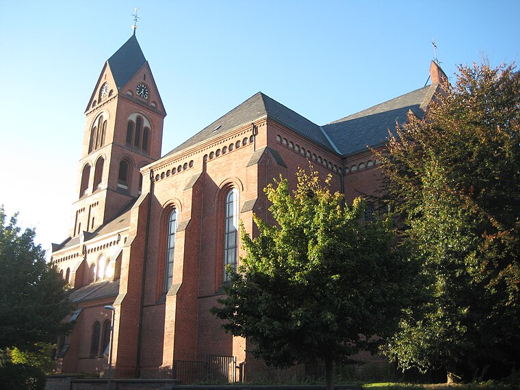
Photo: Die Singularität, CC BY-SA 3.0.
St. Magdalena, Lütgendortmund is a church, which is situated 1¼ km east of Pflegebüro Plus.
Dortmund-Lütgendortmund station
Railway stop

Photo: Platte, CC BY-SA 4.0.
Dortmund-Lütgendortmund station is a single-track, underground terminal station in the city of Dortmund in the German state of North Rhine-Westphalia. The platform is accessible by stairs, escalator or lift. Dortmund-Lütgendortmund station is situated 1½ km east of Pflegebüro Plus.
Places in the Area
Nearby places include Bochum-Werne and Kolonie Landwehr.
Bochum-Werne
Suburb
Bochum-Werne is a district of the city of Bochum in the Ruhr area in North Rhine-Westphalia in Germany. Werne is in the East of Bochum, North of Langendreer. Werne borders the city of Dortmund.

Gerthe
Suburb
Gerthe is a part of the city of Bochum in the Ruhr area in Germany. Up to the 19th century Westphalian was spoken here. Gerthe is a district in the working-class north of Bochum, in the northeast, bordering Herne and Castrop-Rauxel.
Pflegebüro Plus
- Type: Social service facility
- Address: Harpener Hellweg 451, Dortmund, 44388
- Location: Bochum, Arnsberg, Ruhr, North Rhine-Westphalia, Germany, Central Europe, Europe
- View on OpenStreetMap
Latitude
51.50481° or 51° 30′ 17″ northLongitude
7.31439° or 7° 18′ 52″ eastOpen location code
9F39G837+WQOpenStreetMap ID
node 6148165750OpenStreetMap feature
amenity=social_facility
This page is based on OpenStreetMap, Wikidata, and Wikimedia Commons.
We’d love your help improving our open data sources. Thank you for contributing.
Satellite Map
Discover Pflegebüro Plus from above in high-definition satellite imagery.
Notable Places Nearby
Highlights include Martin-Luther-King-Haus and Kornkammer Haus Holte.
Nearby Places
Explore places such as NC NailDesign & Fußpflege and Zahnarztpraxis Andrea Arns.
Ruhr: Must-Visit Destinations
Delve into Dortmund, Essen, Duisburg, and Gelsenkirchen.
Curious Social Service Facilities to Discover
Uncover intriguing social service facilities from every corner of the globe.
About Mapcarta. Data © OpenStreetMap contributors and available under the Open Database License". Text is available under the CC BY-SA 4.0 license, except for photos, directions, and the map. Photo: NatiSythen, Public domain.